Fichier:B2 namous 2010.JPG
Taille de cet aperçu : 577 × 599 pixels. Autres résolutions : 231 × 240 pixels | 462 × 480 pixels | 696 × 723 pixels.
Fichier d’origine (696 × 723 pixels, taille du fichier : 43 kio, type MIME : image/jpeg)
Ce fichier et sa description proviennent de Wikimedia Commons.
Description
| Description |
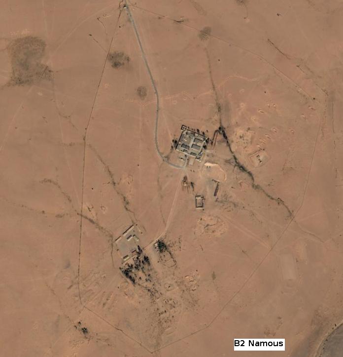
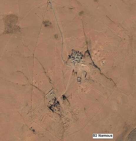
English: An aerial photography of a former French Army installation in Sahara (ex-French Algeria military territory) called B2 Namous. Photo taken from an helicopter by me in February 2008. I've added the caption "B2 Namous" to the photgraphy. The north position shows the checkpoint, the east position is the main installation with an heliport, the west position is the barracks, the border shows the defensive perimeter. Installation is now abandonned. |
| Date | |
| Source | Travail personnel |
| Auteur | Madame Grinderche |
Conditions d’utilisation
Moi, en tant que détenteur des droits d’auteur sur cette œuvre, je la publie sous la licence suivante :
Ce fichier est disponible selon les termes de la licence Creative Commons Attribution 3.0 Non transposée.
- Vous êtes libre :
- de partager – de copier, distribuer et transmettre cette œuvre
- d’adapter – de modifier cette œuvre
- Sous les conditions suivantes :
- paternité – Vous devez donner les informations appropriées concernant l'auteur, fournir un lien vers la licence et indiquer si des modifications ont été faites. Vous pouvez faire cela par tout moyen raisonnable, mais en aucune façon suggérant que l’auteur vous soutient ou approuve l’utilisation que vous en faites.
The picture does not match with the location given by Google earth with the same item.
Historique du fichier
Cliquer sur une date et heure pour voir le fichier tel qu'il était à ce moment-là.
| Date et heure | Vignette | Dimensions | Utilisateur | Commentaire | |
|---|---|---|---|---|---|
| actuel | 3 février 2010 à 10:39 | | 696 × 723 (43 kio) | Madame Grinderche | {{Information |Description={{en|1=An aerial photography of a former French Army installation in Sahara (ex-French Algeria military territory) called B2 Namous. Photo taken from an helicopter by me in February 2010. I've added the caption "B2 Namous" to th |
Utilisation du fichier
Les 2 pages suivantes utilisent ce fichier :