Fichier:Aerial view of the Prairie du Sac Dam during the 2008 flood.jpg
Taille de cet aperçu : 800 × 536 pixels. Autres résolutions : 320 × 214 pixels | 640 × 428 pixels | 1 024 × 685 pixels | 1 280 × 857 pixels | 2 560 × 1 714 pixels | 3 872 × 2 592 pixels.
Fichier d’origine (3 872 × 2 592 pixels, taille du fichier : 5,32 Mio, type MIME : image/jpeg)
Ce fichier et sa description proviennent de Wikimedia Commons.
Description
| Description |
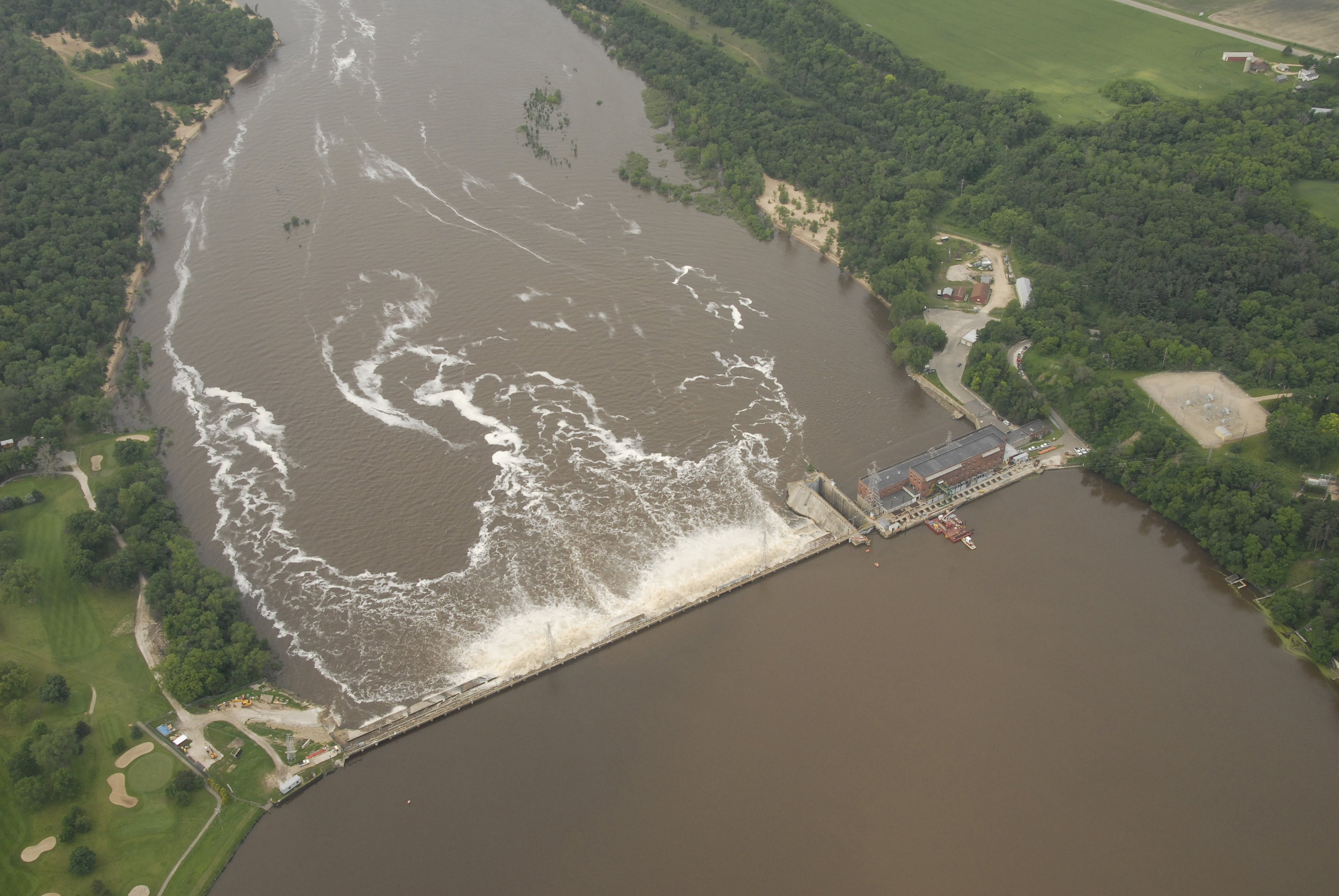
English: An aerial view of the Wisconsin River Dam at Prairie du Sac, Wis., from an UH-60 Blackhawk helicopter June 11, 2008. The dam is one of several dams throughout southern Wisconsin given critical attention in the wake of record rainfalls and widespread flooding. Severe conditions throughout the state prompted Wisconsin Governor Jim Doyle to declare a state of emergency, allowing the Adjutant General, U.S. Air Guard Brigadier General Don Dunbar to activate National Guard troops to assist in the relief effort. (U.S. Air Force photo by Master Sgt. Paul Gorman/Released) |
| Date | |
| Source | www.defenseimagery.mil 080611-F-6967G-006 |
| Auteur | (U.S. Air Force photo by Master Sgt. Paul Gorman/Released) |
Conditions d’utilisation
Cette image ou ce fichier est un travail réalisé par un aviateur ou un employé de l'U.S. Air Force, pris ou fait dans le cadre des fonctions officielles de cette personne. En tant que travail du Gouvernement fédéral des États-Unis, cette image ou ce fichier est dans le domaine public.
|
 |
Historique du fichier
Cliquer sur une date et heure pour voir le fichier tel qu'il était à ce moment-là.
| Date et heure | Vignette | Dimensions | Utilisateur | Commentaire | |
|---|---|---|---|---|---|
| actuel | 18 juin 2008 à 01:25 | | 3 872 × 2 592 (5,32 Mio) | Dual Freq | {{Information |Description={{en|1=An aerial view of the Wisconsin River Dam at Prairie du Sac, Wis., from an UH-60 Blackhawk helicopter June 11, 2008. The dam is one of several dams throughout southern Wisconsin given critical attention in the wake of rec |
Utilisation du fichier
La page suivante utilise ce fichier :
Usage global du fichier
Les autres wikis suivants utilisent ce fichier :
- Utilisation sur en.wikipedia.org
- Utilisation sur www.wikidata.org