Fichier:Yugorsky Peninsula.png
Pas de plus haute résolution disponible.
Yugorsky_Peninsula.png (710 × 534 pixels, taille du fichier : 18 kio, type MIME : image/png)
Ce fichier et sa description proviennent de Wikimedia Commons.
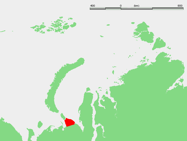
| Description | Location of the Yugorsky Peninsula in Russia: west of Yamal Peninsula and to the southeast of the islands Novaya Zemla and Vaigach | ||||
| Source | w:Image:Kara seaYGP.PNG (originally from demis.nl) | ||||
| Auteur | demis/w:User:Mohonu | ||||
| Autorisation (Réutilisation de ce fichier) |
|
Historique du fichier
Cliquer sur une date et heure pour voir le fichier tel qu'il était à ce moment-là.
| Date et heure | Vignette | Dimensions | Utilisateur | Commentaire | |
|---|---|---|---|---|---|
| actuel | 17 décembre 2007 à 00:27 | | 710 × 534 (18 kio) | Hardscarf | {{Information |Description=Location of the Yugorsky Peninsula in Russia: west of Yamal Peninsula and to the southeast of the islands Novaya Zemla and Vaigach |Source=w:Image:Kara seaYGP.PNG (originally from demis.nl) |Date= |Author=demis/[[:w:User:Mo |
Utilisation du fichier
Les 2 pages suivantes utilisent ce fichier :
Usage global du fichier
Les autres wikis suivants utilisent ce fichier :
- Utilisation sur az.wikipedia.org
- Utilisation sur ca.wikipedia.org
- Utilisation sur en.wikipedia.org
- Utilisation sur es.wikipedia.org
- Utilisation sur fa.wikipedia.org
- Utilisation sur hr.wikipedia.org
- Utilisation sur it.wikipedia.org
- Utilisation sur nl.wikipedia.org
- Utilisation sur nn.wikipedia.org
- Utilisation sur no.wikipedia.org
- Utilisation sur pl.wikipedia.org
- Utilisation sur pl.wiktionary.org
- Utilisation sur pt.wikipedia.org
- Utilisation sur uk.wikipedia.org
- Utilisation sur www.wikidata.org
- Utilisation sur zh.wikipedia.org