Fichier:Wfm jura landsat.jpg

Taille de cet aperçu : 800 × 593 pixels. Autres résolutions : 320 × 237 pixels | 640 × 474 pixels | 1 024 × 758 pixels | 1 280 × 948 pixels.
Fichier d’origine (1 280 × 948 pixels, taille du fichier : 328 kio, type MIME : image/jpeg)
Ce fichier et sa description proviennent de Wikimedia Commons.
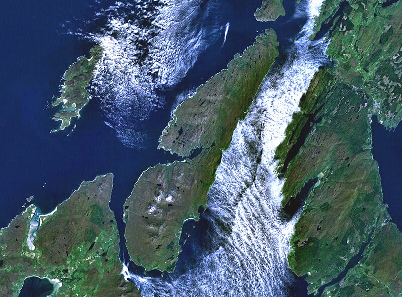
The island of Jura off the west coast of Scotland. The large island to the southwest is Islay, and north of it is Colonsay. To the east is the Kintyre peninsula. The small round island just to the north is Scarba.
This is Landsat7 imagery, collected using NASA World Wind.
| Cette image est dans le domaine public car elle est constituée d'une capture d'écran du logiciel World Wind de la NASA qui utilise des données du domaine public, comme Blue Marble, MODIS, Landsat, SRTM, USGS ou GLOBE.
|
 |
Historique du fichier
Cliquer sur une date et heure pour voir le fichier tel qu'il était à ce moment-là.
| Date et heure | Vignette | Dimensions | Utilisateur | Commentaire | |
|---|---|---|---|---|---|
| actuel | 4 août 2005 à 21:48 | | 1 280 × 948 (328 kio) | Finlay McWalter | The island of Jura off the west coast of Scotland. This is Landsat7 imagery, collected using NASA World Wind. {{PD-USGov-NASA}} category:islands category:scotland category:satellite photos |
Utilisation du fichier
La page suivante utilise ce fichier :
Usage global du fichier
Les autres wikis suivants utilisent ce fichier :
- Utilisation sur br.wikipedia.org
- Utilisation sur cs.wikipedia.org
- Utilisation sur de.wikipedia.org
- Utilisation sur el.wikipedia.org
- Utilisation sur en.wikipedia.org
- Scarba
- Craighouse
- Feolin
- Beinn an Òir
- Beinn Shiantaidh
- Beinn a' Chaolais
- Paps of Jura
- Ardfernal
- Ardmenish
- Jura, Scotland
- Barnhill, Jura
- List of listed buildings in Jura, Argyll and Bute
- Ardlussa Fishing Loch
- Ardfin
- Small Isles, Argyll
- Template:Jura
- Am Fraoch Eilean
- Brosdale Island
- Lagg, Jura
- Tarbert, Jura
- Keils
- Inverlussa
- Kinuachdrachd
- Ardlussa
- Knockrome
- Utilisation sur en.wiktionary.org
- Utilisation sur es.wikipedia.org
- Utilisation sur gl.wikipedia.org
- Utilisation sur it.wikipedia.org
- Utilisation sur ja.wikipedia.org
- Utilisation sur la.wikipedia.org
- Utilisation sur nds.wikipedia.org
- Utilisation sur nl.wikipedia.org
- Utilisation sur nn.wikipedia.org
- Utilisation sur no.wikipedia.org
- Utilisation sur pl.wikipedia.org
- Utilisation sur pt.wikipedia.org
- Utilisation sur sr.wikipedia.org
- Utilisation sur sv.wikipedia.org
- Utilisation sur uk.wikipedia.org
- Utilisation sur www.wikidata.org