Fichier:Topographic Map of the UK - Blank.png
Taille de cet aperçu : 412 × 599 pixels. Autres résolutions : 165 × 240 pixels | 330 × 480 pixels | 528 × 768 pixels | 704 × 1 024 pixels | 1 750 × 2 545 pixels.
Fichier d’origine (1 750 × 2 545 pixels, taille du fichier : 3,63 Mio, type MIME : image/png)
Ce fichier et sa description proviennent de Wikimedia Commons.
Description
| Description |
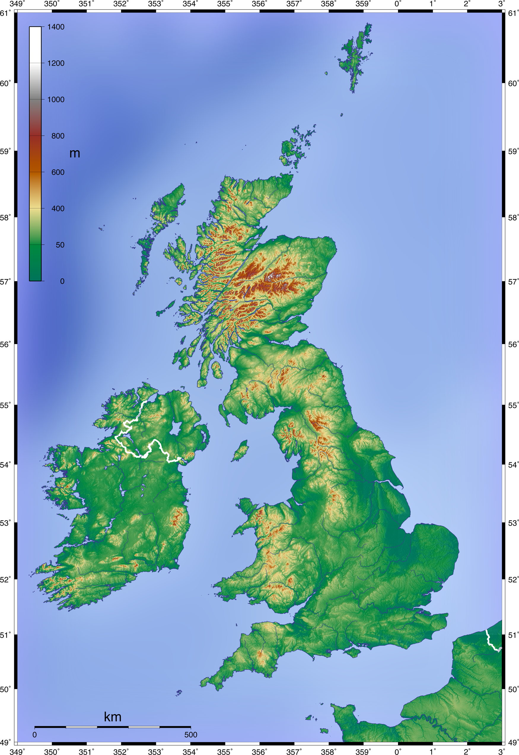
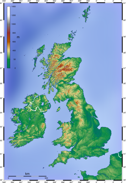
English: Topographic Map of the UK; Mercator projection, 1.750 x 2.545 px (blank w/out dots)
Deutsch: Topographische Karte Großbritanniens; Mercator-Projektion, 1.750 x 2.545 px (unbeschriftet, ohne Punkte) |
| Date | 11 juin 2008 (date de téléversement) |
| Source | Own work by uploader, created with GMT and SRTM data |
| Auteur | Equestenebrarum |
| Autorisation (Réutilisation de ce fichier) |
Creative Commons Attribution 3.0 |
| Autres versions |
Œuvres dérivées de ce fichier : Craven Pass through Pennine Mountains UK topographic map.gif
|


Conditions d’utilisation
Moi, en tant que détenteur des droits d’auteur sur cette œuvre, je la publie sous la licence suivante :
Ce fichier est disponible selon les termes de la licence Creative Commons Attribution 3.0 Non transposée.
- Vous êtes libre :
- de partager – de copier, distribuer et transmettre cette œuvre
- d’adapter – de modifier cette œuvre
- Sous les conditions suivantes :
- paternité – Vous devez donner les informations appropriées concernant l'auteur, fournir un lien vers la licence et indiquer si des modifications ont été faites. Vous pouvez faire cela par tout moyen raisonnable, mais en aucune façon suggérant que l’auteur vous soutient ou approuve l’utilisation que vous en faites.
Historique du fichier
Cliquer sur une date et heure pour voir le fichier tel qu'il était à ce moment-là.
| Date et heure | Vignette | Dimensions | Utilisateur | Commentaire | |
|---|---|---|---|---|---|
| actuel | 11 juin 2008 à 15:07 | | 1 750 × 2 545 (3,63 Mio) | Equestenebrarum | {{Information |Description={{en|1=Topographic Map of the UK; Mercator projection, 1.750 x 2.545 px (blank w/out dots)}} {{de|1=Topographische Karte Großbritanniens; Mercator-Projektion, 1.750 x 2.545 px (unbeschriftet, ohne Punkte)}} |Source=Own work by |
Utilisation du fichier
La page suivante utilise ce fichier :
Usage global du fichier
Les autres wikis suivants utilisent ce fichier :
- Utilisation sur pt.wikipedia.org