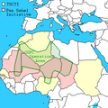
Fichier:Southern Sudan Civil War.svg

Taille de cet aperçu PNG pour ce fichier SVG : 800 × 581 pixels. Autres résolutions : 320 × 232 pixels | 640 × 465 pixels | 1 024 × 743 pixels | 1 280 × 929 pixels | 2 560 × 1 858 pixels | 1 561 × 1 133 pixels.
Fichier d’origine (Fichier SVG, nominalement de 1 561 × 1 133 pixels, taille : 1,71 Mio)
Historique du fichier
Cliquer sur une date et heure pour voir le fichier tel qu'il était à ce moment-là.
| Date et heure | Vignette | Dimensions | Utilisateur | Commentaire | |
|---|---|---|---|---|---|
| actuel | 14 décembre 2021 à 21:20 |  | 1 561 × 1 133 (1,71 Mio) | Borysk5 | Added new map based on 2021 IPIS interactive roadblock map: https://ipisresearch.be/publication/checkpoint-economy-the-political-economy-of-checkpoints-in-south-sudan-ten-years-after-independence/ (selected SPLA-IO and SPLA checkpoints) |
| 22 mars 2020 à 19:19 |  | 1 561 × 1 133 (292 kio) | Borysk5 | Update based on template | |
| 1 avril 2016 à 23:27 |  | 1 561 × 1 133 (255 kio) | Ermanarich | Derived from the Template. Opposition forces arrived in Juba as part of implementation of the Agreement on the Resolution of the Conflict. Wau, Malakal, Nasir, Mir Mir and Rupkuai contested, some v... | |
| 21 février 2016 à 07:50 |  | 1 561 × 1 133 (231 kio) | Oganesson007 | User created page with UploadWizard |
Utilisation du fichier
Les 2 pages suivantes utilisent ce fichier :
Usage global du fichier
Les autres wikis suivants utilisent ce fichier :
- Utilisation sur ar.wikipedia.org
- Utilisation sur az.wikipedia.org
- Utilisation sur bn.wikipedia.org
- Utilisation sur ca.wikipedia.org
- Utilisation sur cs.wikipedia.org
- Utilisation sur de.wikipedia.org
- Utilisation sur de.wikivoyage.org
- Utilisation sur en.wikipedia.org
- Utilisation sur eo.wikipedia.org
- Utilisation sur es.wikipedia.org
- Utilisation sur he.wikipedia.org
- Utilisation sur hi.wikipedia.org
- Utilisation sur id.wikipedia.org
- Utilisation sur it.wikipedia.org
- Utilisation sur ja.wikipedia.org
- Utilisation sur ko.wikipedia.org
- Utilisation sur lv.wikipedia.org
- Utilisation sur pt.wikipedia.org
- Utilisation sur ru.wikipedia.org
- Utilisation sur sr.wikipedia.org
- Utilisation sur te.wikipedia.org
- Utilisation sur th.wikipedia.org
- Utilisation sur tr.wikipedia.org
- Utilisation sur tum.wikipedia.org
- Utilisation sur www.wikidata.org
- Utilisation sur zh.wikipedia.org


