Fichier:Site of Battle of Pwll Melyn (sometimes known as Castle Oak Pond).jpg
Pas de plus haute résolution disponible.
Site_of_Battle_of_Pwll_Melyn_(sometimes_known_as_Castle_Oak_Pond).jpg (640 × 426 pixels, taille du fichier : 122 kio, type MIME : image/jpeg)
Ce fichier et sa description proviennent de Wikimedia Commons.
.jpg?uselang=fr)
Description
| Description |
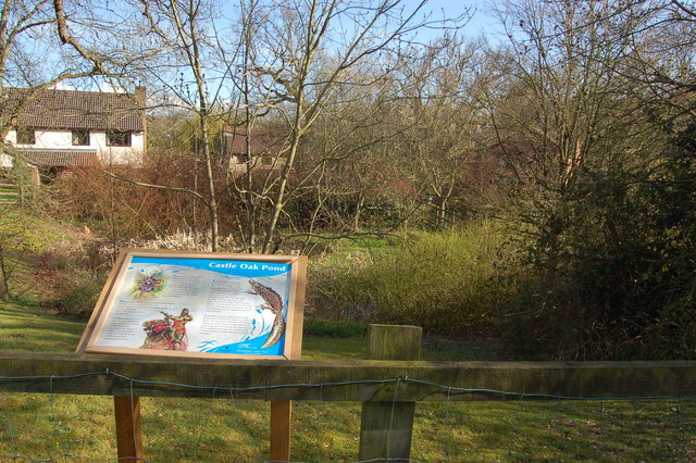
English: Castle Oak pond, Usk This pond was originally excavated in the 1850s to provide water for the steam trains on the line between Little Mill and Monmouth. During the excavation skeletons were found believed to be those slain at the battle of Pwll Melyn in 1405 when Owen Glendower's forces were heavily defeated by those of Henry IV. The line was closed in 1955 by Lord Beeching. Despite now being totally surrounded by the Castle Oak housing estate the pond is home to a rare amphibian -the greater crested newt. |
| Date | |
| Source | From geograph.org.uk |
| Auteur | Roger Davies |
| Attribution (imposé par la licence) | Roger Davies / Castle Oak pond, Usk / |
| Lieu de la prise de vue | | Voir cet endroit et d’autres images sur : OpenStreetMap |
|---|
.jpg¶ms=051.707020_N_-002.901200_E_globe:Earth_type:camera_source:geograph-osgb36(SO37820130)_heading:157.00&language=fr)
| Position de l'objet | | Voir cet endroit et d’autres images sur : OpenStreetMap |
|---|
.jpg¶ms=051.706750_N_-002.901000_E_globe:Earth_class:object_type:object_source:geograph-osgb36(SO37830127)_heading:157.00&language=fr)
Conditions d’utilisation

|
Cette image provient de la collection du projet Geograph British Isles. Pour obtenir les coordonnées du photographe, veuillez consulter cette page de description de l'image sur le site du projet. Les droits d'auteurs sur cette image sont détenus par Roger Davies ; l'image est placée sous une licence Creative Commons avec mention de paternité et partage à l'identique (CC-By-SA) en version 2.0.
|
Ce fichier est disponible selon les termes de la licence Creative Commons Attribution – Partage dans les Mêmes Conditions 2.0 Générique
Attribution: Roger Davies
- Vous êtes libre :
- de partager – de copier, distribuer et transmettre cette œuvre
- d’adapter – de modifier cette œuvre
- Sous les conditions suivantes :
- paternité – Vous devez donner les informations appropriées concernant l'auteur, fournir un lien vers la licence et indiquer si des modifications ont été faites. Vous pouvez faire cela par tout moyen raisonnable, mais en aucune façon suggérant que l’auteur vous soutient ou approuve l’utilisation que vous en faites.
- partage à l’identique – Si vous modifiez, transformez, ou vous basez sur cette œuvre, vous devez distribuer votre contribution sous la même licence ou une licence compatible avec celle de l’original.
Historique du fichier
Cliquer sur une date et heure pour voir le fichier tel qu'il était à ce moment-là.
| Date et heure | Vignette | Dimensions | Utilisateur | Commentaire | |
|---|---|---|---|---|---|
| actuel | 19 février 2011 à 12:57 | | 640 × 426 (122 kio) | GeographBot | == {{int:filedesc}} == {{Information |description={{en|1=Castle Oak pond, Usk This pond was originally excavated in the 1850s to provide water for the steam trains on the line between Little Mill and Monmouth. During the excavation skeletons were found be |
Utilisation du fichier
La page suivante utilise ce fichier :
Usage global du fichier
Les autres wikis suivants utilisent ce fichier :
- Utilisation sur cy.wikipedia.org
- Utilisation sur de.wikipedia.org
- Utilisation sur en.wikipedia.org
- Utilisation sur www.wikidata.org
.jpg)