Fichier:ScotlandAberdeenshireBuchan.png
Pas de plus haute résolution disponible.
ScotlandAberdeenshireBuchan.png (191 × 261 pixels, taille du fichier : 4 kio, type MIME : image/png)
Ce fichier et sa description proviennent de Wikimedia Commons.
Description
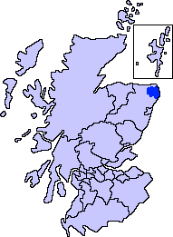
| Description | Aberdeenshire unitary council - Buchan Area |
| Source | Slightly edited version of a map drawn by Morwen and Voyager |
| Auteur |
Conditions d’utilisation
Moi, en tant que détenteur des droits d’auteur sur cette œuvre, je la publie sous les licences suivantes :

|
Vous avez la permission de copier, distribuer et modifier ce document selon les termes de la GNU Free Documentation License version 1.2 ou toute version ultérieure publiée par la Free Software Foundation, sans sections inaltérables, sans texte de première page de couverture et sans texte de dernière page de couverture. Un exemplaire de la licence est inclus dans la section intitulée GNU Free Documentation License. |
| Ce fichier est disponible selon les termes de la licence Creative Commons Attribution – Partage dans les Mêmes Conditions 3.0 (non transposée). | ||
| ||
| Ce bandeau de licence a été ajouté à ce fichier dans le cadre de la procédure de mise à jour des licences des images sous GFDL. |
Vous pouvez choisir l’une de ces licences.
Historique du fichier
Cliquer sur une date et heure pour voir le fichier tel qu'il était à ce moment-là.
| Date et heure | Vignette | Dimensions | Utilisateur | Commentaire | |
|---|---|---|---|---|---|
| actuel | 8 novembre 2007 à 03:30 | | 191 × 261 (4 kio) | Harami2000 | == Summary == == Summary == {{Information |Description= Aberdeenshire unitary council - Buchan Area |Source= Slightly edited version of a map drawn by Morwen and Voyager |Date= |Author= |Permission= |other_versio |
Utilisation du fichier
La page suivante utilise ce fichier :
Usage global du fichier
Les autres wikis suivants utilisent ce fichier :
- Utilisation sur en.wikipedia.org
- Buchan
- New Slains Castle
- Loch of Strathbeg
- Cruden Bay
- St Fergus
- Crimond
- Peterhead
- Old Deer
- Maud, Aberdeenshire
- Whinnyfold
- Formartine and Buchan Way
- Bullers of Buchan
- Buchanhaven
- Deer Abbey
- New Deer
- Crimonmogate
- Rattray Head
- Lonmay
- Mintlaw
- Aden Country Park
- Longside
- Strichen
- Rattray, Aberdeenshire
- Fetterangus
- New Pitsligo
- Auchnagatt
- Template:Buchan, Aberdeenshire places
- Boddam, Aberdeenshire
- Hatton, Aberdeenshire
- St Combs
- Stuartfield
- Inverugie
- Clola
- Rora, Aberdeenshire
- New Leeds
- Stirling Village
- Longhaven
- Downiehills
- Kirktown of St Fergus
- Utilisation sur fa.wikipedia.org