Fichier:SJC Airport Diagram.svg

Taille de cet aperçu PNG pour ce fichier SVG : 378 × 545 pixels. Autres résolutions : 166 × 240 pixels | 333 × 480 pixels | 533 × 768 pixels | 710 × 1 024 pixels | 1 420 × 2 048 pixels.
Fichier d’origine (Fichier SVG, nominalement de 378 × 545 pixels, taille : 658 kio)
Ce fichier et sa description proviennent de Wikimedia Commons.
Description
| Description |
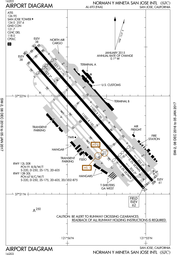
English: FAA Airport Diagram of airport: SJC |
| Date | |
| Source |
FAA Airport Diagrams; note that these change every 28 days. Taken from PDF on FAA site and converted to SVG using en:Wikipedia:How to draw SVG circuits using Xcircuit. |
| Auteur | Produced by the National Aeronautical Charting Office (NACO), a department of the United States en:Federal Aviation Administration. |
| Autres versions | File:SJC - FAA airport diagram.gif, File:KSJC.png |
| Lieu de la prise de vue | | Voir cet endroit et d’autres images sur : OpenStreetMap |
|---|
W3C-validity not checked.
Conditions d’utilisation
This image or file is a work of a Federal Aviation Administration employee, taken or made as part of that person's official duties. As a work of the U.S. federal government, the image is in the public domain in the United States.
|
 |
Historique du fichier
Cliquer sur une date et heure pour voir le fichier tel qu'il était à ce moment-là.
| Date et heure | Vignette | Dimensions | Utilisateur | Commentaire | |
|---|---|---|---|---|---|
| actuel | 10 janvier 2017 à 20:43 | | 378 × 545 (658 kio) | Grendelkhan | SVG version of FAA's PDF diagram. |
| 20 août 2014 à 09:46 |  | 378 × 548 (653 kio) | Grendelkhan | SVG version of FAA's PDF diagram. |
Utilisation du fichier
La page suivante utilise ce fichier :
Usage global du fichier
Les autres wikis suivants utilisent ce fichier :
- Utilisation sur af.wikipedia.org
- Utilisation sur de.wikipedia.org
- Utilisation sur en.wikipedia.org
- Utilisation sur es.wikipedia.org
- Utilisation sur id.wikipedia.org
- Utilisation sur ja.wikipedia.org
- Utilisation sur ur.wikipedia.org
- Utilisation sur vi.wikipedia.org
- Utilisation sur www.wikidata.org
- Utilisation sur zh.wikipedia.org