Fichier d’origine(740 × 734 pixels, taille du fichier : 167 kio, type MIME : image/png)

Ce fichier et sa description proviennent de Wikimedia Commons.

Description

Description
Deutsch: Karte der Nidder
English: Map of the Nidder
Date 12.09.2006
Source demis.nl PD-Karte, selbst bearbeitet / PD-map, edited by myself
Auteur MdE Use rpage at German Wikipedia User page at Commons


Conditions d’utilisation

I, MdE, created this map and publish the file under the following license. If there is more than one license, you may choose one which is better for you and use the file outside Wikipedia under the license terms. Crediting is mandatory in any case and may be sufficient depending on the license (e.g. with CC-BY-SA):
At the picture, in the picture credits or in the imprint Nidder Karte.png, © MdE at Wikimedia Commons, CC-BY-SA 3.0“, in online media with hyperlink to my user page and to this page (as in preceding example).
  • Using a picture without compilance is chargeable an will be invoiced! See fee advice of the Mittelstandsgemeinschaft Foto-Marketing (MFM) plus surcharge for noncompilance.
  • A special license for you (including cost-free usage) may be available on request, also in some cases a higher resolution.
  • If you have any questions, feel free to contact me on my discussion page (unregistered writing possible, I will reply quickly) or send me an E-Mail (registered users only).
w:fr:Creative Commons
paternité partage à l’identique
Ce fichier est disponible selon les termes de la licence Creative Commons Attribution – Partage dans les Mêmes Conditions 3.0 (non transposée).
Vous êtes libre :
  • de partager – de copier, distribuer et transmettre cette œuvre
  • d’adapter – de modifier cette œuvre
Sous les conditions suivantes :
  • paternité – Vous devez donner les informations appropriées concernant l'auteur, fournir un lien vers la licence et indiquer si des modifications ont été faites. Vous pouvez faire cela par tout moyen raisonnable, mais en aucune façon suggérant que l’auteur vous soutient ou approuve l’utilisation que vous en faites.
  • partage à l’identique – Si vous modifiez, transformez, ou vous basez sur cette œuvre, vous devez distribuer votre contribution sous la même licence ou une licence compatible avec celle de l’original.

This file is copyrighted and has been released under licenses which are incompatible with Facebook's licensing terms. Therefore, it is not permitted to upload this file to Facebook.

Légendes

Ajoutez en une ligne la description de ce que représente ce fichier

Éléments décrits dans ce fichier

dépeint

Historique du fichier

Cliquer sur une date et heure pour voir le fichier tel qu'il était à ce moment-là.

Date et heureVignetteDimensionsUtilisateurCommentaire
actuel12 septembre 2006 à 18:58Vignette pour la version du 12 septembre 2006 à 18:58740 × 734 (167 kio)MdE
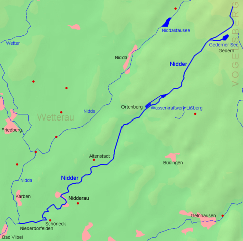
{{User:MdE*C/FotoCC |InfoDE=Karte der Nidder |InfoEN=Map of the ''Nidder'' |Datum=12.09.2006 |Quelle=[http://www.demis.nl/ demis.nl] PD-Karte, selbst bearbeitet / PD-map, edited by myself |Kategorie=Maps of Hesse }} [[Category:Wetteraukreis

La page suivante utilise ce fichier :

Usage global du fichier

Les autres wikis suivants utilisent ce fichier :