Fichier:NASA Mando-Koresand.png
Taille de cet aperçu : 612 × 599 pixels. Autres résolutions : 245 × 240 pixels | 620 × 607 pixels.
Fichier d’origine (620 × 607 pixels, taille du fichier : 962 kio, type MIME : image/png)
Ce fichier et sa description proviennent de Wikimedia Commons.
Description
| Description |
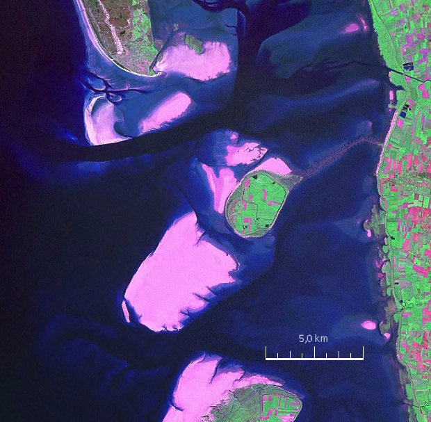
English: Mandø, the Danish Wadden Island, with Koresand close southwest, Fanø to the north, Romø to the south and the Jutland mainland coast to the east |
| Date | |
| Source | NASA World Wind Screen Shot |
| Auteur | NASA |
Conditions d’utilisation
| Cette image est dans le domaine public car elle est constituée d'une capture d'écran du logiciel World Wind de la NASA qui utilise des données du domaine public, comme Blue Marble, MODIS, Landsat, SRTM, USGS ou GLOBE.
|
 |
| Annotations | Cette image est annotée : Voir les annotations sur Wikimedia Commons |
Historique du fichier
Cliquer sur une date et heure pour voir le fichier tel qu'il était à ce moment-là.
| Date et heure | Vignette | Dimensions | Utilisateur | Commentaire | |
|---|---|---|---|---|---|
| actuel | 19 août 2009 à 19:57 | | 620 × 607 (962 kio) | Ratzer | {{Information |Description={{en|1=Mandø, the Danish Wadden Island, with Koresand close southwest, Fanø to the north, Romø to the south and the Jutland mainland coast to the east}} |Source=NASA World Wind Screen Shot |Author=NASA |Date=2000 |Permission= |
Utilisation du fichier
La page suivante utilise ce fichier :
Usage global du fichier
Les autres wikis suivants utilisent ce fichier :
- Utilisation sur da.wikipedia.org
- Utilisation sur de.wikipedia.org
- Utilisation sur frr.wikipedia.org
- Utilisation sur fy.wikipedia.org
- Utilisation sur hu.wikipedia.org
- Utilisation sur no.wikipedia.org
- Utilisation sur sv.wikipedia.org