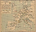
Fichier:Mediaeval universities.jpg

Taille de cet aperçu : 685 × 599 pixels. Autres résolutions : 274 × 240 pixels | 549 × 480 pixels | 878 × 768 pixels | 1 127 × 986 pixels.
Fichier d’origine (1 127 × 986 pixels, taille du fichier : 1,17 Mio, type MIME : image/jpeg)
Historique du fichier
Cliquer sur une date et heure pour voir le fichier tel qu'il était à ce moment-là.
| Date et heure | Vignette | Dimensions | Utilisateur | Commentaire | |
|---|---|---|---|---|---|
| actuel | 30 juillet 2012 à 18:31 |  | 1 127 × 986 (1,17 Mio) | SteveMcCluskey | Improved legibility by reducing extraneous background detail, increasing contrast of image, and enhancing color saturation of underlining. |
| 20 septembre 2011 à 20:38 |  | 1 127 × 986 (353 kio) | SreeBot | (Original text) : {{PD}} Scan from "Historical Atlas" by William R. Shepherd, New York, Henry Holt and Company, 1923. Original image at the [http://www.lib.utexas.edu/maps/ Perry-Castañeda Library Map Collection] at the [[University of Texas at Austin |
Utilisation du fichier
Les 6 pages suivantes utilisent ce fichier :
Usage global du fichier
Les autres wikis suivants utilisent ce fichier :
- Utilisation sur ast.wikipedia.org
- Utilisation sur azb.wikipedia.org
- Utilisation sur az.wikipedia.org
- Utilisation sur ca.wikipedia.org
- Utilisation sur cs.wikipedia.org
- Utilisation sur en.wikipedia.org
- Utilisation sur es.wikipedia.org
- Utilisation sur id.wikipedia.org
- Utilisation sur ja.wikipedia.org
- Utilisation sur ka.wikipedia.org
- Utilisation sur pt.wikipedia.org
- Utilisation sur sq.wikipedia.org
- Utilisation sur uk.wikipedia.org
- Utilisation sur uz.wikipedia.org
- Utilisation sur www.wikidata.org