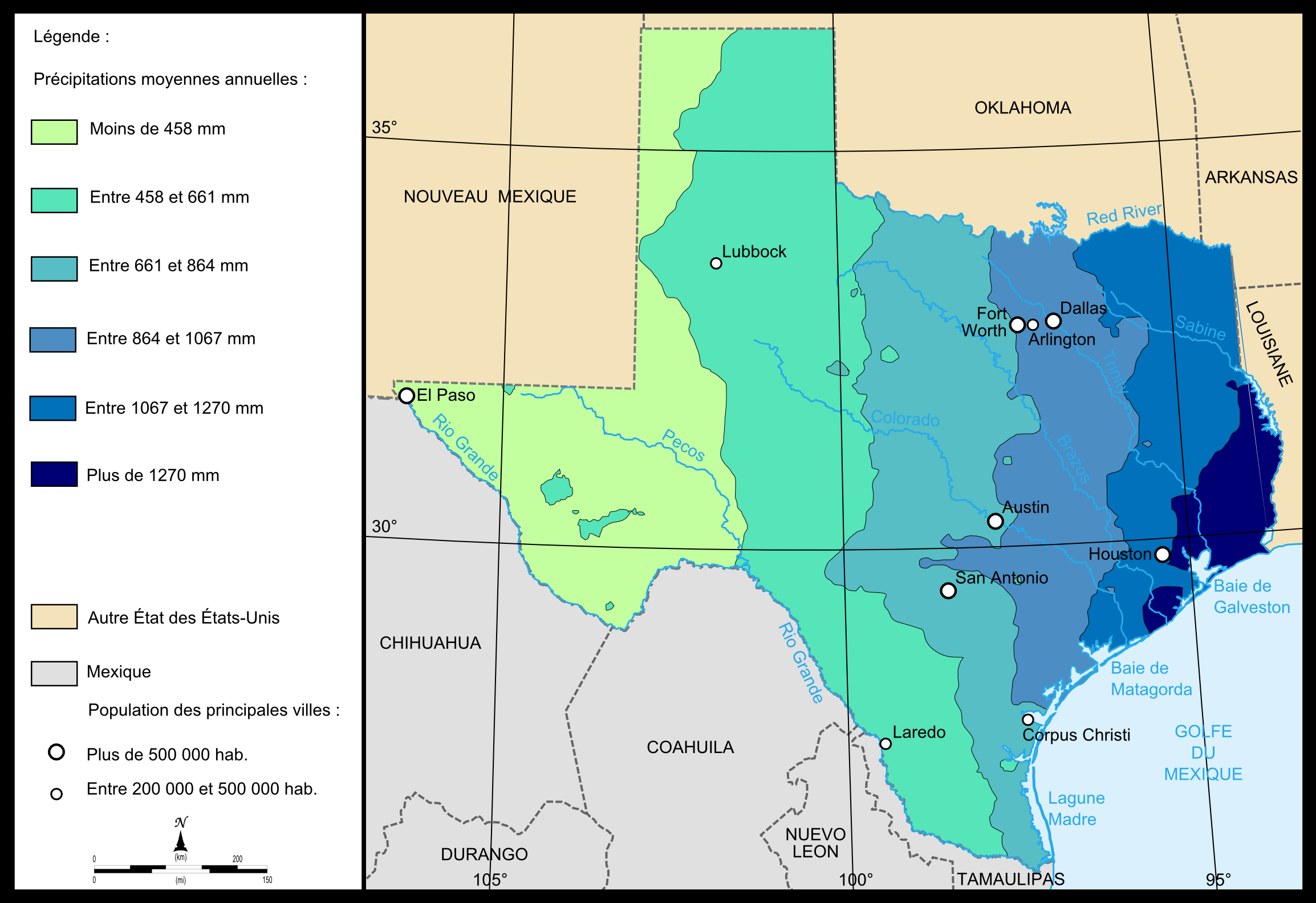
Fichier:Map of Texas precipitations.png
Taille de cet aperçu : 800 × 549 pixels. Autres résolutions : 320 × 220 pixels | 640 × 439 pixels | 1 024 × 703 pixels | 1 280 × 878 pixels | 2 308 × 1 584 pixels.
Fichier d’origine (2 308 × 1 584 pixels, taille du fichier : 579 kio, type MIME : image/png)
Ce fichier et sa description proviennent de Wikimedia Commons.
own work
29-06-2012
| Moi, propriétaire des droits d’auteur sur cette œuvre, la place dans le domaine public. Ceci s'applique dans le monde entier. Dans certains pays, ceci peut ne pas être possible ; dans ce cas : J’accorde à toute personne le droit d’utiliser cette œuvre dans n’importe quel but, sans aucune condition, sauf celles requises par la loi. |
Historique du fichier
Cliquer sur une date et heure pour voir le fichier tel qu'il était à ce moment-là.
| Date et heure | Vignette | Dimensions | Utilisateur | Commentaire | |
|---|---|---|---|---|---|
| actuel | 30 août 2008 à 16:24 | | 2 308 × 1 584 (579 kio) | Urban~commonswiki | Category:Maps of Texas own work august 2008 {{pd-self}} |
| 30 août 2008 à 12:11 |  | 2 247 × 1 546 (580 kio) | Urban~commonswiki | own work august 2008 {{pd-self}} category:maps of Texas | |
| 30 août 2008 à 11:39 |  | 2 308 × 1 584 (579 kio) | Urban~commonswiki | own work {{pd-self}} 28-08-2008 Category:Maps of Texas | |
| 30 août 2008 à 11:35 |  | 2 308 × 1 584 (579 kio) | Urban~commonswiki | own work 29-08-2008 {{pd-self}} Category:Maps of Texas |
Utilisation du fichier
Les 5 pages suivantes utilisent ce fichier :
Usage global du fichier
Les autres wikis suivants utilisent ce fichier :
- Utilisation sur es.wikipedia.org
- Utilisation sur fa.wikipedia.org
- Utilisation sur it.wikipedia.org