Fichier:ISS-42 Richat Structure.jpg

Taille de cet aperçu : 800 × 532 pixels. Autres résolutions : 320 × 213 pixels | 640 × 426 pixels | 1 024 × 682 pixels | 1 280 × 852 pixels | 2 560 × 1 704 pixels | 4 928 × 3 280 pixels.
Fichier d’origine (4 928 × 3 280 pixels, taille du fichier : 4,21 Mio, type MIME : image/jpeg)
Ce fichier et sa description proviennent de Wikimedia Commons.
Description
| Description |
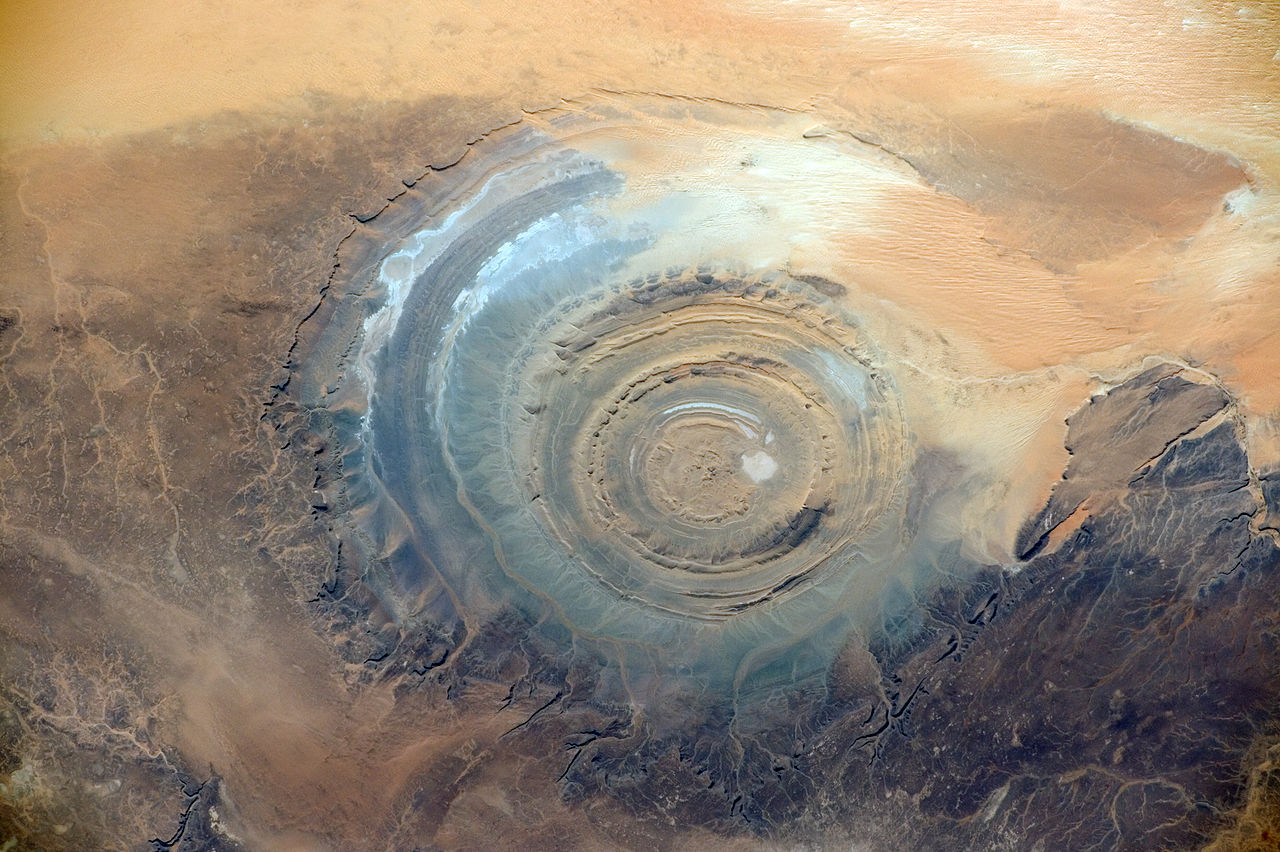
English: The Richat Structure, also known as the Eye of the Sahara and Guelb er Richat, is a prominent circular feature in the Sahara desert near Ouadane, west–central Mauritania.
|
| Date | Prise le 22 novembre 2014, 09:47:38 UTC |
| Source | https://www.flickr.com/photos/nasa2explore/16824767220/ |
| Auteur | NASA |
Cette image ou vidéo a été cataloguée par le Johnson Space Center de la National Aeronautics and Space Administration (NASA) des États-Unis sous Photo ID : ISS042-E-007131.Ce bandeau n’indique rien sur le statut de l’œuvre au regard du droit d'auteur. Un bandeau de droit d’auteur est requis. Voir Commons:À propos des licences pour plus d’informations. Autres langues :
|
Conditions d’utilisation
"The Gateway to Astronaut Photography of Earth". Image provenant du Laboratoire d'Analyse et d'Imagerie des Sciences, Centre Spatial Johnson de la NASA.
Source de la photo : ISS042-E-007131.
|
Historique du fichier
Cliquer sur une date et heure pour voir le fichier tel qu'il était à ce moment-là.
| Date et heure | Vignette | Dimensions | Utilisateur | Commentaire | |
|---|---|---|---|---|---|
| actuel | 31 mars 2015 à 04:05 | | 4 928 × 3 280 (4,21 Mio) | Ras67 | new rendered in high quality from NASA's raw image data |
| 31 mars 2015 à 00:44 |  | 4 928 × 3 280 (980 kio) | Ras67 | =={{int:filedesc}}== {{Information |description={{en|1=The '''Richat Structure''', also known as the '''Eye of the Sahara''' and '''Guelb er Richat''', is a prominent circular feature in the w:Sahara desert near w:Ouadane, west–central [[... |
Utilisation du fichier
Les 4 pages suivantes utilisent ce fichier :
Usage global du fichier
Les autres wikis suivants utilisent ce fichier :
- Utilisation sur fi.wikipedia.org