Fichier:Flint River in Flint MIchigan.jpg
Taille de cet aperçu : 800 × 529 pixels. Autres résolutions : 320 × 211 pixels | 640 × 423 pixels | 1 024 × 677 pixels | 1 500 × 991 pixels.
Fichier d’origine (1 500 × 991 pixels, taille du fichier : 479 kio, type MIME : image/jpeg)
Ce fichier et sa description proviennent de Wikimedia Commons.
| Description |
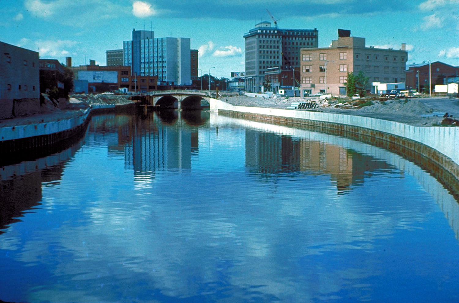
English: The Flint River in Flint, Michigan, USA, in the late 1970s during a U.S. Army Corps of Engineers flood control project, Taken from approximately halfway between the Grand Traverse Street bridge and Beach-Garland Street bridge, looking east. To the right in the distance is the former IMA Auditorium, later part of AutoWorld, demolished in 1997 to make way for an expansion of UM-Flint. The Northbank Center, to the right of the upper center of the photograph, is also now part of UM-Flint. |
|||
| Date | vers 1979 | |||
| Source |
U.S. Army Corps of Engineers Digital Visual Library Image page Image description page Digital Visual Library home page |
|||
| Auteur | U.S. Army Corps of Engineers, photographer not specified or unknown | |||
| Autorisation (Réutilisation de ce fichier) |
|
|||
| Lieu | Flint, Michigan, USA |
| Lieu de la prise de vue | | Voir cet endroit et d’autres images sur : OpenStreetMap |
|---|
Historique du fichier
Cliquer sur une date et heure pour voir le fichier tel qu'il était à ce moment-là.
| Date et heure | Vignette | Dimensions | Utilisateur | Commentaire | |
|---|---|---|---|---|---|
| actuel | 29 mars 2007 à 03:50 | | 1 500 × 991 (479 kio) | DanMS | {{Information | Description = {{en|The Flint River in Flint, Michigan, USA. The U.S. Army Corps of Engineers has constructed a flood control project in the city.}} | Source = U.S. Army Corps of Engineers Digital Visual Library<br />[http://imag |
Utilisation du fichier
La page suivante utilise ce fichier :
Usage global du fichier
Les autres wikis suivants utilisent ce fichier :
- Utilisation sur br.wikipedia.org
- Utilisation sur en.wikipedia.org
- Utilisation sur eo.wikipedia.org
- Utilisation sur es.wikipedia.org
- Utilisation sur fa.wikipedia.org
- Utilisation sur it.wikipedia.org
- Utilisation sur ko.wikipedia.org
- Utilisation sur lb.wikipedia.org
- Utilisation sur mk.wikipedia.org
- Utilisation sur oc.wikipedia.org
- Utilisation sur ru.wikipedia.org
- Utilisation sur sh.wikipedia.org
- Utilisation sur sr.wikipedia.org