Fichier:Daugava western dvina map.jpg
Taille de cet aperçu : 649 × 599 pixels. Autres résolutions : 260 × 240 pixels | 520 × 480 pixels | 832 × 768 pixels | 1 276 × 1 178 pixels.
Fichier d’origine (1 276 × 1 178 pixels, taille du fichier : 254 kio, type MIME : image/jpeg)
Ce fichier et sa description proviennent de Wikimedia Commons.

|
Cette image (de type carte) devrait être recréée dans un format vectoriel, en tant que fichier SVG. Cela offrirait plusieurs avantages : voir Commons:Media for cleanup pour plus d'informations. Si une version SVG de cette image est déjà disponible, merci de bien vouloir l'envoyer. Après cela, remplacez ce modèle par {{vector version available|nouveau nom d'image.svg}}.
|


Description
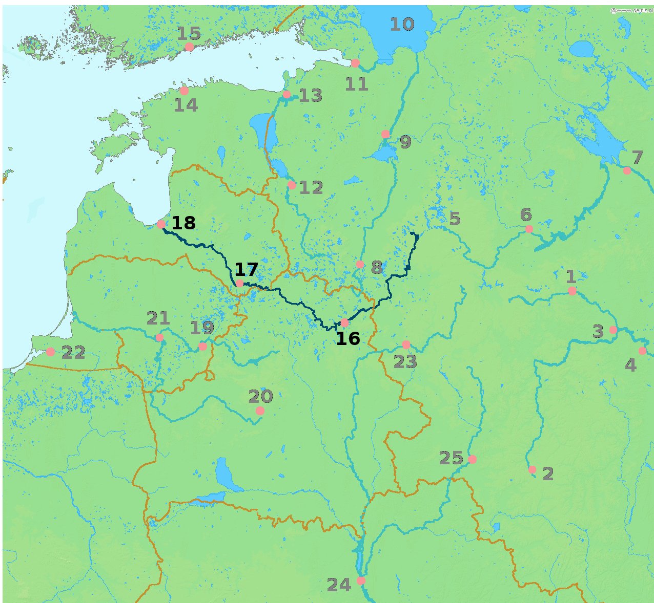
| Description | Map highlighting the river Daugava/Western Dvina (Daugava, Западная Двина́ (Zapadnaya Dvina), traditionally Дзвiна or newly Заходняя Дзвіна) flowing through Vitebsk (16), Daugavpils (17) and Riga (18). |
| Date | 13 mars 2010, 17:59 (UTC) |
| Source | |
| Auteur |
|
| Cette image a été retouchée, ce qui signifie qu'elle a été modifiée par ordinateur et est différente de l'image d'origine. Liste des modifications : Highlighted the Daugava river and cities it passes through. L'image d'origine se trouve ici : LA2-Rivers of western Russia.png:
|
This image is in the public domain because it came from the site https://www.demis.nl/products/web-map-server/examples/ and was released by the copyright holder. Permission is granted to copy, distribute and/or modify this map since it is based on free of copyright images from: www.demis.nl. See also approval email on de.wp and its clarification.
|
| This work has been released into the public domain by its copyright holder, www.demis.nl. This applies worldwide. Dans certains pays, ceci peut ne pas être possible ; dans ce cas : www.demis.nl accorde à toute personne le droit d’utiliser cette œuvre dans n’importe quel but, sans aucune condition, sauf celles requises par la loi.
|
Journal des téléversements d’origine
This image is a derivative work of the following images:
- File:LA2-Rivers_of_western_Russia.png licensed with PD-Demis
- 2008-05-20T22:30:46Z LA2 1274x1178 (269354 Bytes) {{Information |Description=Map of western Russia, with national borders marked (brown), rivers emphasized (dark blue) and major cities (pink) numbered (black). Bounding box West 19°, South 50°, East 40°, North 61°. Center
Téléversé avec derivativeFX
Historique du fichier
Cliquer sur une date et heure pour voir le fichier tel qu'il était à ce moment-là.
| Date et heure | Vignette | Dimensions | Utilisateur | Commentaire | |
|---|---|---|---|---|---|
| actuel | 13 mars 2010 à 19:59 | | 1 276 × 1 178 (254 kio) | Alþykkr | {{Information |Description=Map highlighting the river Daugava/Western Dvina ({{lang-lv|Daugava}}, {{lang-ru|Западная Двина́ (Zapadnaya Dvina)}}, {{lang-be|traditionally Дзвiна or newly Заходняя Дзвіна}}, {{IPA2|zaˈxodnʲa |
Utilisation du fichier
Usage global du fichier
Les autres wikis suivants utilisent ce fichier :
- Utilisation sur be-tarask.wikipedia.org
- Utilisation sur be.wikipedia.org
- Utilisation sur da.wikipedia.org
- Utilisation sur de.wikipedia.org
- Utilisation sur eu.wikipedia.org
- Utilisation sur pl.wikipedia.org