Fichier:Church of St Peter and St Paul, Borden - geograph.org.uk - 655985.jpg
Pas de plus haute résolution disponible.
Church_of_St_Peter_and_St_Paul,_Borden_-_geograph.org.uk_-_655985.jpg (640 × 444 pixels, taille du fichier : 157 kio, type MIME : image/jpeg)
Ce fichier et sa description proviennent de Wikimedia Commons.
Description
| Description |
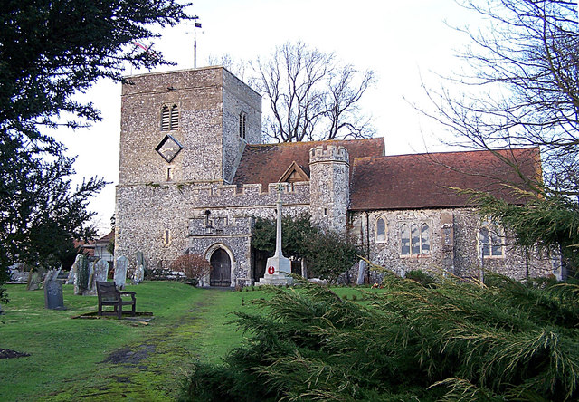
English: Church of St Peter and St Paul, Borden Supposed to have been erected about the year 1005, comprises three aisles and three chancels, with a square tower at the western end. There are some Roman bricks mixed with the flint stones in the building, and cemented with mortar in the composition of which pulverized cockle-shells have been used.
From: 'Bonchurch - Borden', A Topographical Dictionary of England (1848), pp. 302-305. URL: http://www.british-history.ac.uk/report.aspx?compid=50812. Date accessed: 12 January 2008. |
| Date | |
| Source | From geograph.org.uk |
| Auteur | Richard Dorrell |
| Attribution (imposé par la licence) | Richard Dorrell / Church of St Peter and St Paul, Borden / |
| Lieu de la prise de vue | | Voir cet endroit et d’autres images sur : OpenStreetMap |
|---|
_heading:0.00&language=fr)
| Position de l'objet | | Voir cet endroit et d’autres images sur : OpenStreetMap |
|---|
_heading:0.00&language=fr)
Conditions d’utilisation

|
Cette image provient de la collection du projet Geograph British Isles. Pour obtenir les coordonnées du photographe, veuillez consulter cette page de description de l'image sur le site du projet. Les droits d'auteurs sur cette image sont détenus par Richard Dorrell ; l'image est placée sous une licence Creative Commons avec mention de paternité et partage à l'identique (CC-By-SA) en version 2.0.
|
Ce fichier est disponible selon les termes de la licence Creative Commons Attribution – Partage dans les Mêmes Conditions 2.0 Générique
Attribution: Richard Dorrell
- Vous êtes libre :
- de partager – de copier, distribuer et transmettre cette œuvre
- d’adapter – de modifier cette œuvre
- Sous les conditions suivantes :
- paternité – Vous devez donner les informations appropriées concernant l'auteur, fournir un lien vers la licence et indiquer si des modifications ont été faites. Vous pouvez faire cela par tout moyen raisonnable, mais en aucune façon suggérant que l’auteur vous soutient ou approuve l’utilisation que vous en faites.
- partage à l’identique – Si vous modifiez, transformez, ou vous basez sur cette œuvre, vous devez distribuer votre contribution sous la même licence ou une licence compatible avec celle de l’original.
Historique du fichier
Cliquer sur une date et heure pour voir le fichier tel qu'il était à ce moment-là.
| Date et heure | Vignette | Dimensions | Utilisateur | Commentaire | |
|---|---|---|---|---|---|
| actuel | 7 février 2011 à 16:26 | | 640 × 444 (157 kio) | GeographBot | == {{int:filedesc}} == {{Information |description={{en|1=Church of St Peter and St Paul, Borden Supposed to have been erected about the year 1005, comprises three aisles and three chancels, with a square tower at the western end. There are some Roman bric |
Utilisation du fichier
La page suivante utilise ce fichier :
Usage global du fichier
Les autres wikis suivants utilisent ce fichier :
- Utilisation sur ceb.wikipedia.org
- Utilisation sur cy.wikipedia.org
- Utilisation sur en.wikipedia.org
- Utilisation sur it.wikipedia.org
- Utilisation sur lld.wikipedia.org
- Utilisation sur pl.wikipedia.org
- Utilisation sur www.wikidata.org