Fichier:CHS - FAA airport diagram.png
Taille de cet aperçu : 390 × 599 pixels. Autres résolutions : 156 × 240 pixels | 312 × 480 pixels | 651 × 1 000 pixels.
Fichier d’origine (651 × 1 000 pixels, taille du fichier : 181 kio, type MIME : image/png)
Ce fichier et sa description proviennent de Wikimedia Commons.
| Description |
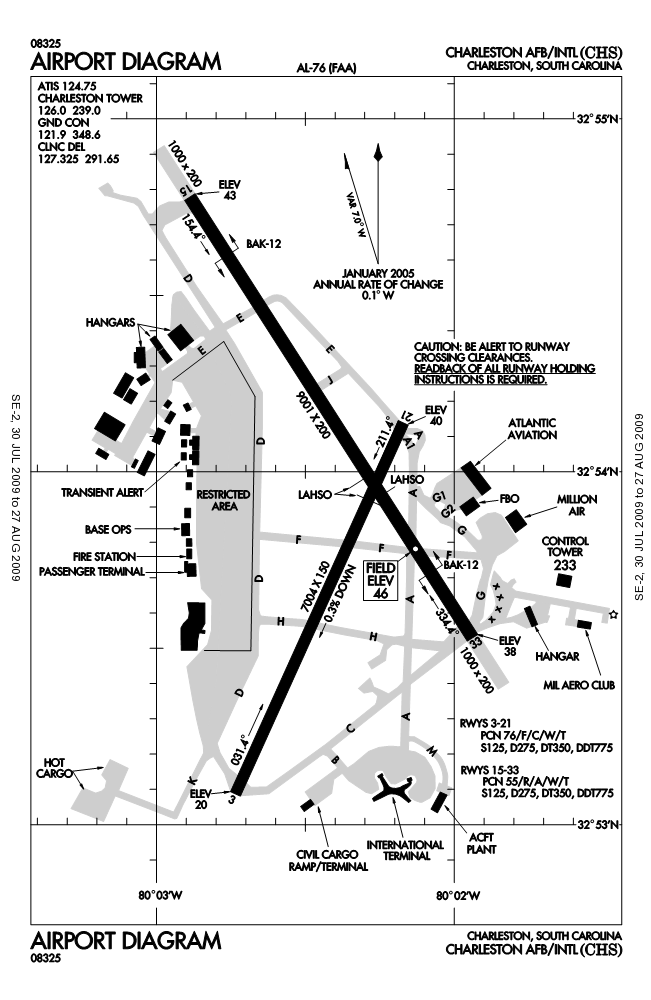
English: FAA airport diagram for Charleston International Airport (CHS) in North Charleston, South Carolina, United States. |
|||
| Date | Effective 2009-07-30 to 2009-08-27. | |||
| Source |
http://naco.faa.gov/d-tpp/0908/00076AD.PDF Note: this URL changes every 28 days; the airport article should contain a link to the current FAA diagram. |
|||
| Auteur | Produced by the National Aeronautical Charting Office (NACO), a department of the Federal Aviation Administration (FAA). | |||
| Autorisation (Réutilisation de ce fichier) |
|

Historique du fichier
Cliquer sur une date et heure pour voir le fichier tel qu'il était à ce moment-là.
| Date et heure | Vignette | Dimensions | Utilisateur | Commentaire | |
|---|---|---|---|---|---|
| actuel | 9 août 2009 à 06:54 | | 651 × 1 000 (181 kio) | Spyder Monkey | {{Information | Description = {{en|FAA airport diagram for {{w|Charleston International Airport}} (CHS) in Charleston, South Carolina, United States.}} | Source = http://naco.faa.gov/d-tpp/0908/00076AD.PDF<br>Note: this URL changes [[:en:Aeronautical Info |
Utilisation du fichier
La page suivante utilise ce fichier :
Usage global du fichier
Les autres wikis suivants utilisent ce fichier :
- Utilisation sur de.wikipedia.org
- Utilisation sur no.wikipedia.org
- Utilisation sur ur.wikipedia.org