Fichier:Arrowrock Dam.jpg
Pas de plus haute résolution disponible.
Arrowrock_Dam.jpg (298 × 245 pixels, taille du fichier : 24 kio, type MIME : image/jpeg)
Ce fichier et sa description proviennent de Wikimedia Commons.
|
Ceci est une photographie d’un monument référencé dans le National Register of Historic Places des États-Unis sous le numéro 72000437. |
| Lieu de la prise de vue | | Voir cet endroit et d’autres images sur : OpenStreetMap |
|---|
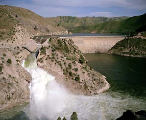
| Description | Downstream view of the Arrowrock Dam on the Boise River near Boise in Boise County, Idaho, United States. Constructed in 1912, the dam is listed on the National Register of Historic Places. | |||
| Date | Date inconnue | |||
| Source | Copied from this picture, shown on this United States Bureau of Reclamation webpage | |||
| Auteur | Auteur inconnu | |||
| Autorisation (Réutilisation de ce fichier) |
|

Historique du fichier
Cliquer sur une date et heure pour voir le fichier tel qu'il était à ce moment-là.
| Date et heure | Vignette | Dimensions | Utilisateur | Commentaire | |
|---|---|---|---|---|---|
| actuel | 29 mars 2009 à 05:23 | | 298 × 245 (24 kio) | Nyttend | {{Location|43|35|44|N|115|55|19|W}} {{Information |Description=Downstream view of the {{w|Arrowrock Dam}} near {{w|Boise, Idaho|Boise}} in {{w|Boise County, Idaho|Boise County}}, {{w|Idaho}}, {{w|United States}}. Constructed in 1912, the dam is listed on |
Utilisation du fichier
Les 2 pages suivantes utilisent ce fichier :
Usage global du fichier
Les autres wikis suivants utilisent ce fichier :
- Utilisation sur ceb.wikipedia.org
- Utilisation sur de.wikipedia.org
- Utilisation sur en.wikipedia.org
- Utilisation sur ru.wikipedia.org
- Utilisation sur sv.wikipedia.org
- Utilisation sur www.wikidata.org