Fichier:Vimy Ridge map-April 9-April 12.jpg
Fichier d’origine (1 472 × 943 pixels, taille du fichier : 389 kio, type MIME : image/jpeg)
Ce fichier et sa description proviennent de Wikimedia Commons.
Description
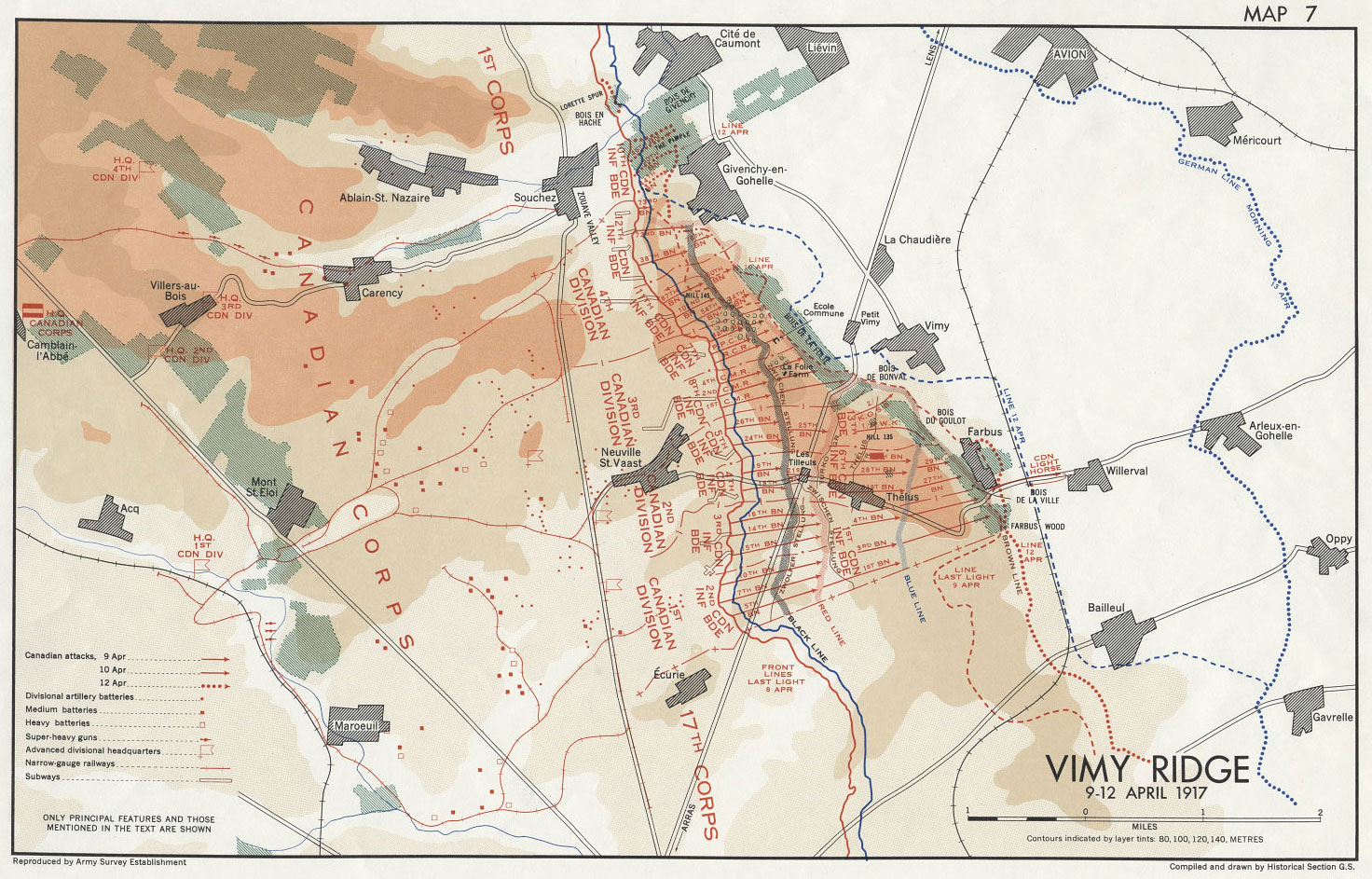
| Description | 'Map 7 Vimy Ridge' from Nicholson text, Compiled and drawn by Historical Section of the General Staff, Department of National Defence |
| Source | Canadian War Museum file CWM19980056-280 & Nicholson, G. W. L. 1962. Official History of the Canadian Army in the First World War: Canadian Expeditionary Force 1914-1919. Queens Printer and Controller of Stationary, Ottawa, Canada. |
| Auteur | Historical Section of the General Staff, Department of National Defence |
| Autorisation (Réutilisation de ce fichier) |
Library and Archives Canada, http://www.collectionscanada.gc.ca/notices/016-200-e.html |
Conditions d’utilisation
Cette œuvre canadienne est dans le domaine public au Canada pour l'une ou l'autre des raisons suivantes découlant de la Loi sur le droit d’auteur :
elle n'était pas soumise au droit d'auteur de la Couronne, et
|
 |
Journal des téléversements d’origine
The original description page is/was here. All following user names refer to en.wikipedia.
- 19:27, January 5, 2008 Labattblueboy 1,472×943 (389 KB) {{Information |Description= 'Map 7 Vimy Ridge' Compiled and drawn by Historical Section of the General Staff, Department of National Defence |Source= Canadian War Museum file CWM19980056-280 & Nicholson, G. W. L. 1962. Official History of the Canadian Arm
Historique du fichier
Cliquer sur une date et heure pour voir le fichier tel qu'il était à ce moment-là.
| Date et heure | Vignette | Dimensions | Utilisateur | Commentaire | |
|---|---|---|---|---|---|
| actuel | 5 janvier 2008 à 22:54 | | 1 472 × 943 (389 kio) | Labattblueboy | {{Information |Description= 'Map 7 Vimy Ridge' from Nicholson text, Compiled and drawn by Historical Section of the General Staff, Department of National Defence |Source= Canadian War Museum file CWM19980056-280 & Nicholson, G. W. L. 1962. Official Histor |
Utilisation du fichier
La page suivante utilise ce fichier :
Usage global du fichier
Les autres wikis suivants utilisent ce fichier :
- Utilisation sur en.wikipedia.org
- Utilisation sur it.wikipedia.org