Fichier:Tropical Depression One 2009 GOES.jpg

Taille de cet aperçu : 800 × 600 pixels. Autres résolutions : 320 × 240 pixels | 640 × 480 pixels | 1 024 × 768 pixels | 1 280 × 960 pixels.
Fichier d’origine (1 280 × 960 pixels, taille du fichier : 1 021 kio, type MIME : image/jpeg)
Ce fichier et sa description proviennent de Wikimedia Commons.
Description
| Description |
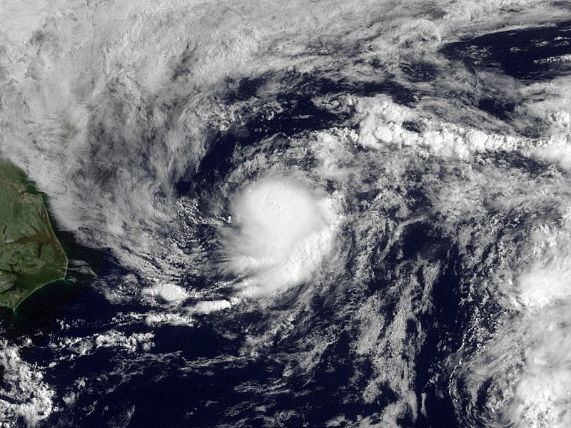
English: Shower activity has increased this morning in association with the area of low pressure located about 225 miles east-northeast of Cape Hatteras North Carolina. The low is currently moving to the northeast at 15 MPH along the relatively warm waters of the gulf stream. This system still has some potential to become a tropical cyclone over the next 12-24 hours but is not expected to threaten any land areas. |
| Date | |
| Source | http://www.nnvl.noaa.gov/MediaDetail.php?MediaID=210&MediaTypeID=1 |
| Auteur | NOAA; GOES |
| Autorisation (Réutilisation de ce fichier) |
Public domain |
Conditions d’utilisation
Cette image est dans le domaine public car son contenu provient de la
National Oceanic and Atmospheric Administration , réalisé par un employé dans le cadre de ses activités professionnelles.
|
Historique du fichier
Cliquer sur une date et heure pour voir le fichier tel qu'il était à ce moment-là.
| Date et heure | Vignette | Dimensions | Utilisateur | Commentaire | |
|---|---|---|---|---|---|
| actuel | 18 mars 2013 à 22:27 | | 1 280 × 960 (1 021 kio) | Supportstorm | Fix |
| 15 mai 2010 à 01:02 |  | 1 280 × 960 (1 001 kio) | Supportstorm | Contrast Correction | |
| 15 août 2009 à 22:09 |  | 1 280 × 960 (886 kio) | Cyclonebiskit | {{Information |Description={{en|1=Shower activity has increased this morning in association with the area of low pressure located about 225 miles east-northeast of Cape Hatteras North Carolina. The low is currently moving to the northeast at 15 MPH along |
Utilisation du fichier
Les 2 pages suivantes utilisent ce fichier :
Usage global du fichier
Les autres wikis suivants utilisent ce fichier :
- Utilisation sur bg.wikipedia.org
- Utilisation sur de.wikipedia.org
- Utilisation sur en.wikipedia.org
- Utilisation sur es.wikipedia.org
- Utilisation sur eu.wikipedia.org
- Utilisation sur nl.wikipedia.org
- Utilisation sur pt.wikipedia.org
- Utilisation sur ru.wikipedia.org
- Utilisation sur zh.wikipedia.org