Fichier:Texas and Pacific Railway Shortest Line to the Great Cotton, Grain and Stock Regions of Texas 1878 UTA.jpg

Taille de cet aperçu : 653 × 600 pixels. Autres résolutions : 261 × 240 pixels | 523 × 480 pixels | 836 × 768 pixels | 1 115 × 1 024 pixels | 2 230 × 2 048 pixels | 2 927 × 2 688 pixels.
Fichier d’origine (2 927 × 2 688 pixels, taille du fichier : 1,86 Mio, type MIME : image/jpeg)
Ce fichier et sa description proviennent de Wikimedia Commons.
Description
| Titre |
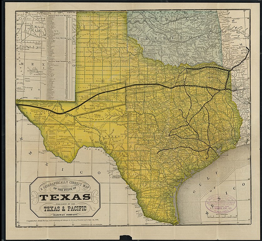
English: A Geographically Correct Map of the State of Texas |
||||||||||||||||||||||||||
| Date | |||||||||||||||||||||||||||
| Source | UTA Libraries Cartographic Connections: carte / texte | ||||||||||||||||||||||||||
| Créé par |
Auteur inconnu |
||||||||||||||||||||||||||
| Attribution de l’acquisition |
English: The University of Texas at Arlington Libraries Special Collections |
||||||||||||||||||||||||||
| Données géotemporelles | |||||||||||||||||||||||||||
| Lieu | Texas | ||||||||||||||||||||||||||
| Géoréférencement | Si c'est inapproprié, définissez warp_status = skip pour masquer. | ||||||||||||||||||||||||||
| Données bibliographiques | |||||||||||||||||||||||||||
| Lieu de publication | Saint-Louis | ||||||||||||||||||||||||||
| Éditeur de publication |
Woodward, Tiernan & Hale (for the Texas & Pacific Railway Company) |
||||||||||||||||||||||||||
| Données d'archives | |||||||||||||||||||||||||||
| Collection |
|
||||||||||||||||||||||||||
Conditions d’utilisation

|
This file was provided to Wikimedia Commons by the University of Texas at Arlington Libraries as part of a cooperation project. The University of Texas at Arlington Libraries is part of the University of Texas at Arlington, a public research university located in Arlington, Texas.
|
Cette œuvre a été publiée avant le 1er janvier 1929. Son auteur n'étant pas connu, cette œuvre est anonyme. Elle est donc dans le domaine public aux États-Unis, ainsi que dans les pays où la durée du droit d'auteur pour les œuvres anonymes est inférieure à 95 ans après la date de première publication.
|
Historique du fichier
Cliquer sur une date et heure pour voir le fichier tel qu'il était à ce moment-là.
| Date et heure | Vignette | Dimensions | Utilisateur | Commentaire | |
|---|---|---|---|---|---|
| actuel | 2 avril 2022 à 22:06 | | 2 927 × 2 688 (1,86 Mio) | Michael Barera | == {{int:filedesc}} == {{Map |title = {{en|'''''A Geographically Correct Map of the State of Texas'''''}} |description = |legend = |author = {{Unknown|author}} |date = 1878 |source = UTA Libraries ''Cartographic Connections'': [https://libguides.uta.edu/ld.php?content_id=931877 {{I18n/map}}] / [https://libguides.uta.edu/ccon {{I18n/text}}] |permission = |map date = |location = {{Texas}} |projec... |
Utilisation du fichier
La page suivante utilise ce fichier :
Usage global du fichier
Les autres wikis suivants utilisent ce fichier :
- Utilisation sur de.wikipedia.org
- Utilisation sur en.wikipedia.org
- Utilisation sur it.wikipedia.org