Fichier:Odessa Impact Crater Aerial.jpg

Fichier d’origine(2 544 × 2 277 pixels, taille du fichier : 4,21 Mio, type MIME : image/jpeg)

Ce fichier et sa description proviennent de Wikimedia Commons.

Description

Description
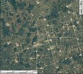
English: Aerial image centered on the Odessa Meteor Crater in the southwestern part of Ector County, southwest of the city of Odessa, Texas. The dark green circular, oval, to roughly circular features in the area surrounding this extraterrestrial impact crater are playa lakes that occupy shallow depressions of terrestrial, nonimpact origin. The light-colored rectangular features are well pads of oil wells. Constructed from 2008 county NAIP Digital Ortho Photo coverage for Ector County, Texas, from USDA/NRCS - National Cartography & Geospatial Center using Global Mapper 12.0 and Adobe Illustrator. Latitude 31° 45' 21.78" N., Longitude 102° 28' 44.08" W.
Date
Source USDA/FSA Aerial Photography Field Office
Auteur USDA/FSA Aerial Photography Field Office

Conditions d’utilisation

Public domain
Ce média est dans le domaine public des États-Unis d’Amérique car son auteur est l’administration américaine comme précisé dans le code fédéral au Titre 17, Chapitre 1, Section 105. Pour en savoir plus : droit d’auteur. Attention : Ceci ne concerne que le travail du Gouvernement Fédéral et pas celui des États, ou d’une autre subdivision géographique ou politique du pays.

Historique du fichier

Cliquer sur une date et heure pour voir le fichier tel qu'il était à ce moment-là.

Date et heureVignetteDimensionsUtilisateurCommentaire
actuel4 juillet 2011 à 03:29Vignette pour la version du 4 juillet 2011 à 03:292 544 × 2 277 (4,21 Mio)Cristellaria

La page suivante utilise ce fichier :

Usage global du fichier

Les autres wikis suivants utilisent ce fichier :

Métadonnées