Fichier:Nuclear plants map France.jpg
Taille de cet aperçu : 626 × 600 pixels. Autres résolutions : 250 × 240 pixels | 501 × 480 pixels | 801 × 768 pixels | 1 200 × 1 150 pixels.
Fichier d’origine (1 200 × 1 150 pixels, taille du fichier : 740 kio, type MIME : image/jpeg)
Ce fichier et sa description proviennent de Wikimedia Commons.
Description
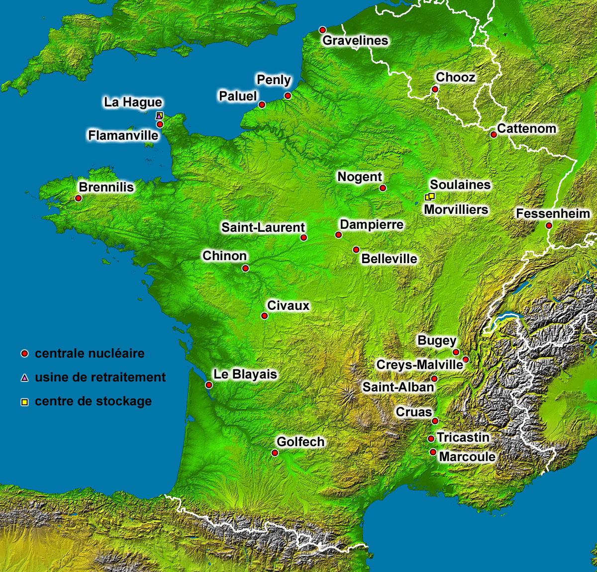
| Description |
English: Map of the French nuclear power plants (in French).
Français : Carte en français des centrales nucléaires, usines de retraitement et centres de stockage français. |
| Date | |
| Source | Background map : Image:France_radar_2.jpg, a modified version from the NASA Earth Observatory |
| Auteur | Eric Gaba (Sting - fr:Sting) |
| Autorisation (Réutilisation de ce fichier) |
Public domain |
| Autres versions |
|

Conditions d’utilisation
| Ce fichier provient de la NASA. Sauf exception, les documents créés par la NASA ne sont pas soumis à copyright. Pour plus d'informations, voir la politique de copyright de la NASA. | ||
 |
Attention :
|
| This work was previously under Public Domain, or a Free License. It has been digitally enhanced and/or modified. This derivative work has been (or is hereby) released into the public domain by its author, Sting at the French Wikipedia project. This applies worldwide. In some countries this is not legally possible; if so:
|
Historique du fichier
Cliquer sur une date et heure pour voir le fichier tel qu'il était à ce moment-là.
| Date et heure | Vignette | Dimensions | Utilisateur | Commentaire | |
|---|---|---|---|---|---|
| actuel | 1 septembre 2006 à 16:35 | | 1 200 × 1 150 (740 kio) | Sting | Lightning effect around names enhanced |
| 30 août 2006 à 07:49 |  | 1 200 × 1 150 (709 kio) | Sting | {{Information |Description=Map of the French nuclear power plants (in French) |Source=Background map : Image:France_radar_2.jpg, a modified version from the [http://earthobservatory.nasa.gov/Newsroom/NewImages/images.php3?img_id=15360 NASA Earth Obse |
Utilisation du fichier
La page suivante utilise ce fichier :
Usage global du fichier
Les autres wikis suivants utilisent ce fichier :
- Utilisation sur es.wikipedia.org
- Utilisation sur zh.wikipedia.org