Fichier:Mississippi Gulf Coast New Orleans to Mobile 1953 Map.jpg
Taille de cet aperçu : 800 × 564 pixels. Autres résolutions : 320 × 226 pixels | 640 × 451 pixels | 1 024 × 722 pixels | 1 280 × 902 pixels | 2 560 × 1 805 pixels | 6 733 × 4 746 pixels.
Fichier d’origine (6 733 × 4 746 pixels, taille du fichier : 10,98 Mio, type MIME : image/jpeg)
Ce fichier et sa description proviennent de Wikimedia Commons.
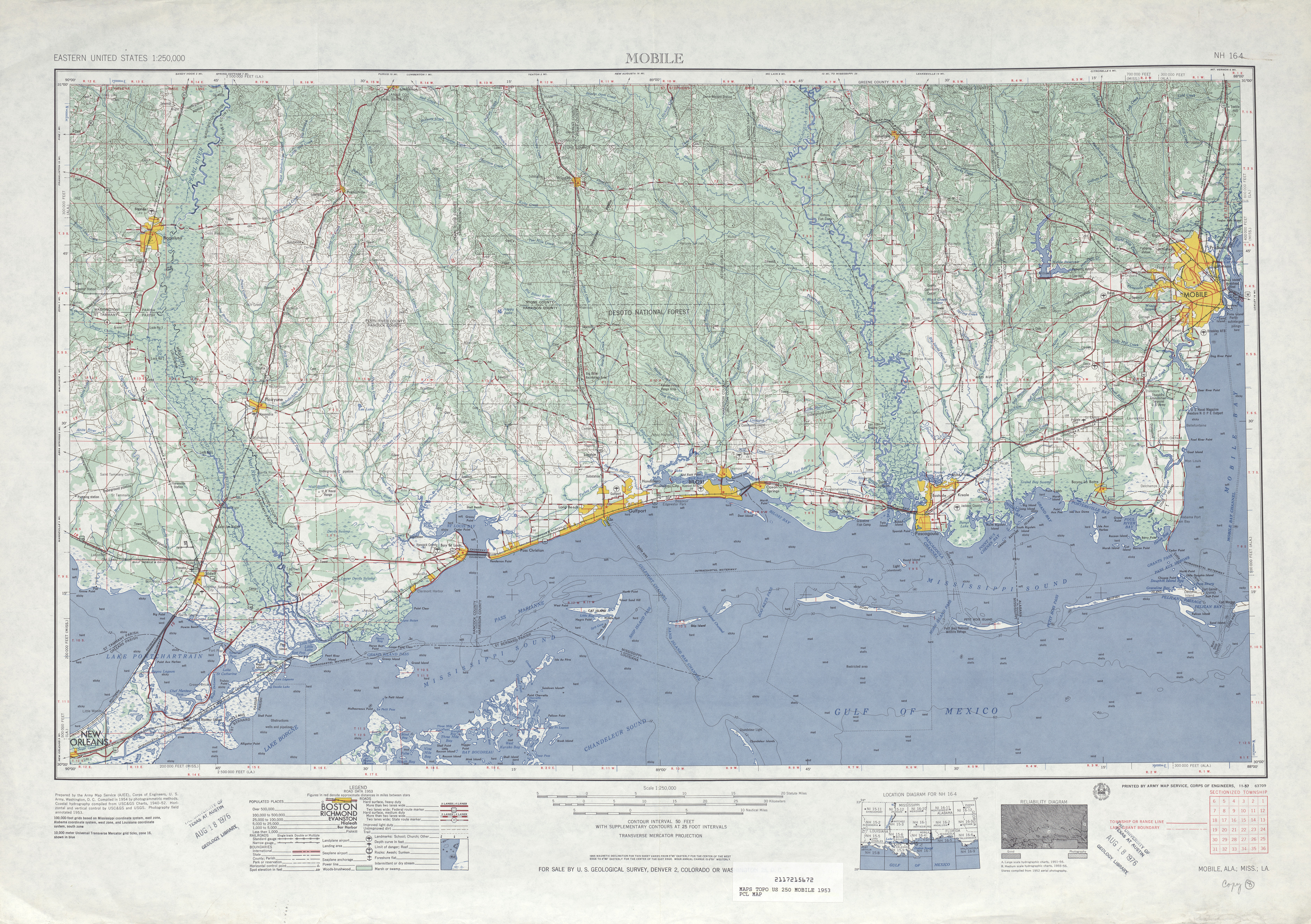
| Description | 1953 map of the Mississippi Gulf Coast and neighboring areas, from the eastern edge of New Orleans to Mobile Bay. Including the towns and cities of Slidell, Louisiana; Waveland, Bay St. Louis, Pass Christian, Gulfport, Biloxi, Ocean Springs, and Pascagoula, Mississippi; Bayou La Batre and Mobile, Alabama. | ||||||
| Date | |||||||
| Source | U.S. Geological Survey map, 1953, via [1] | ||||||
| Auteur | U.S. Geological Survey | ||||||
| Autorisation (Réutilisation de ce fichier) |
|
||||||

Historique du fichier
Cliquer sur une date et heure pour voir le fichier tel qu'il était à ce moment-là.
| Date et heure | Vignette | Dimensions | Utilisateur | Commentaire | |
|---|---|---|---|---|---|
| actuel | 20 juin 2012 à 01:18 | | 6 733 × 4 746 (10,98 Mio) | Infrogmation | {{Information |Description= 1953 map of the Mississippi Gulf Coast and neighboring areas, from the eastern edge of New Orleans to Mobile Bay. Including the towns and cities of Slidell, Louisiana; Waveland, Bay St. Louis, Pass Christian, Gulfport, Bilox... |
Utilisation du fichier
La page suivante utilise ce fichier :