Fichier:Marodi Jeh location map relief.svg

Taille de cet aperçu PNG pour ce fichier SVG : 429 × 582 pixels. Autres résolutions : 177 × 240 pixels | 354 × 480 pixels | 566 × 768 pixels | 755 × 1 024 pixels | 1 509 × 2 048 pixels.
Fichier d’origine (Fichier SVG, nominalement de 429 × 582 pixels, taille : 381 kio)
Ce fichier et sa description proviennent de Wikimedia Commons.
Description
| Description |
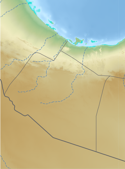
English: Relief map of Marodi Jeh, for geo-location purposes
|
| Date | |
| Source | See below |
| Auteur | See below (Assembly by User:Freetrashbox) |
Sources
- Global Relief: ETOPO Global Relief Model / NOAA (2022-10-04). Ice surface elevation geotiff. Retrieved on 2022-12-13. / ETOPO_2022_v1_15s_N00W030_surface.tif, ETOPO_2022_v1_15s_N15E030_surface.tif
- International border: GSHHG data version 2.3.7 / NOAA (2017-06-15). Shoreline / Coastline Resources. Retrieved on 2022-12-13. / gshhg-shp-2.3.7\WDBII_shp\h\WDBII_border_h_L1.shp
- Intermittent rivers: GSHHG data version 2.3.7 / ibid. / gshhg-shp-2.3.7\WDBII_shp\h\WDBII_river_h_L08.shp
- Regional border of Somaliland: SOMALILAND VULNERABILITY INDEX MAP / Ministry of Planning and National Development of Somaliland. SOMALILAND VULNERABILITY INDEX MAP. Retrieved on 2022-12-13.
Design
- Global Relief: Wikipedia:Graphics Lab/Resources/GIS sources and palettes
- International border: R100 G100 B100, 2pts.
- Intermittent rivers: R72 G123 B182, 1pt, dash 5 pts, blank 3pts.
- Regional border of Somaliland: R100 G100 B100, 1pt.
Conditions d’utilisation
Cette image est dans le domaine public car son contenu provient de la
National Oceanic and Atmospheric Administration , réalisé par un employé dans le cadre de ses activités professionnelles.
|
Historique du fichier
Cliquer sur une date et heure pour voir le fichier tel qu'il était à ce moment-là.
| Date et heure | Vignette | Dimensions | Utilisateur | Commentaire | |
|---|---|---|---|---|---|
| actuel | 13 décembre 2022 à 13:31 | | 429 × 582 (381 kio) | Freetrashbox | Uploaded a work by NOAA from https://www.ngdc.noaa.gov/mgg/global/relief/ETOPO2022/data/15s/15s_surface_elev_gtif/ with UploadWizard |
Utilisation du fichier
La page suivante utilise ce fichier :
Usage global du fichier
Les autres wikis suivants utilisent ce fichier :
- Utilisation sur en.wikipedia.org
- Utilisation sur si.wikipedia.org
- Utilisation sur uz.wikipedia.org