Fichier:Map of Somerset County Pennsylvania School Districts.png
Pas de plus haute résolution disponible.
Map_of_Somerset_County_Pennsylvania_School_Districts.png (435 × 449 pixels, taille du fichier : 19 kio, type MIME : image/png)
Ce fichier et sa description proviennent de Wikimedia Commons.
Description
| Description |
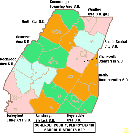
English: Map of Somerset County, Pennsylvania, United States Public School Districts |
| Date | |
| Source | taken from US Census website and modified by User:Ruhrfisch |
| Auteur |
Original : US Census Travail dérivé : Ruhrfisch |
| Autorisation (Réutilisation de ce fichier) |
US Census / US Government work is public domain, my modifications licensed under the GNU Free Documentation License |
Conditions d’utilisation

|
Vous avez la permission de copier, distribuer et modifier ce document selon les termes de la GNU Free Documentation License version 1.2 ou toute version ultérieure publiée par la Free Software Foundation, sans sections inaltérables, sans texte de première page de couverture et sans texte de dernière page de couverture. Un exemplaire de la licence est inclus dans la section intitulée GNU Free Documentation License. |
| Ce fichier est disponible selon les termes de la licence Creative Commons Attribution – Partage dans les Mêmes Conditions 3.0 (non transposée). | ||
| ||
| Ce bandeau de licence a été ajouté à ce fichier dans le cadre de la procédure de mise à jour des licences des images sous GFDL. |
Historique du fichier
Cliquer sur une date et heure pour voir le fichier tel qu'il était à ce moment-là.
| Date et heure | Vignette | Dimensions | Utilisateur | Commentaire | |
|---|---|---|---|---|---|
| actuel | 19 juin 2006 à 22:23 | | 435 × 449 (19 kio) | Ruhrfisch | {{Information| |Description= Map of Somerset County, Pennsylvania, United States Public School Districts |Source= taken from US Census website [http://factfinder.census.gov/] and modified by User:Ruhrfisch |Date= June 2006 |Author= US Census, Ruhrfi |
Utilisation du fichier
La page suivante utilise ce fichier :
Usage global du fichier
Les autres wikis suivants utilisent ce fichier :
- Utilisation sur en.wikipedia.org
- Somerset County, Pennsylvania
- North Star School District
- Berlin Brothersvalley School District
- Somerset Area School District
- Turkeyfoot Valley Area School District
- Salisbury-Elk Lick School District
- Conemaugh Township Area School District
- Windber Area School District
- Meyersdale Area School District
- Rockwood Area School District
- Shade-Central City School District
- Shanksville-Stonycreek School District
- User:Epoloch/sandbox
- Utilisation sur ja.wikipedia.org