Fichier:Map of Morocco and Western Sahara-fr.svg

Taille de cet aperçu PNG pour ce fichier SVG : 531 × 599 pixels. Autres résolutions : 213 × 240 pixels | 425 × 480 pixels | 681 × 768 pixels | 908 × 1 024 pixels | 1 816 × 2 048 pixels | 625 × 705 pixels.
Fichier d’origine (Fichier SVG, nominalement de 625 × 705 pixels, taille : 234 kio)
Ce fichier et sa description proviennent de Wikimedia Commons.
| Description |
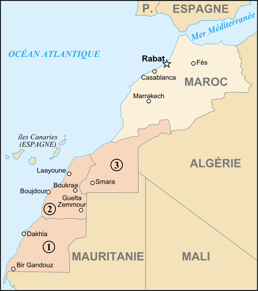
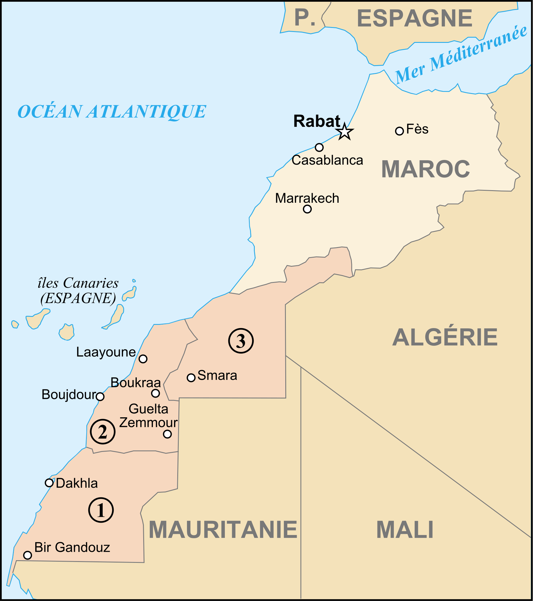
Français : Carte du Maroc et du Sahara Occidental English: Map of Marocco and Western Sahara |
||||||||
| Date | |||||||||
| Source | fr:Image:Régions du sud.png + Image:Maroc carte.gif + Image:Sahara occidental CIA WFB.png + Own work | ||||||||
| Auteur | historicair 00:27, 8 August 2007 (UTC) | ||||||||
| Autorisation (Réutilisation de ce fichier) |
Moi, en tant que détenteur des droits d’auteur sur cette œuvre, je la publie sous les licences suivantes :
Ce fichier est sous licence Creative Commons Attribution – Partage dans les Mêmes Conditions 2.5 Générique, 2.0 Générique et 1.0 Générique.
Vous pouvez choisir l’une de ces licences. |
||||||||
| Autres versions | العربيَّة |

| Annotations | Cette image est annotée : Voir les annotations sur Wikimedia Commons |
Historique du fichier
Cliquer sur une date et heure pour voir le fichier tel qu'il était à ce moment-là.
| Date et heure | Vignette | Dimensions | Utilisateur | Commentaire | |
|---|---|---|---|---|---|
| actuel | 8 août 2007 à 02:27 | | 625 × 705 (234 kio) | Historicair | {{Information |Description={{fr}}Carte du Maroc et du Sahara Occidental {{en}}Map of Marocco and Western Sahara |Source=fr:Image:Régions du sud.png + Image:Maroc carte.gif + Image:Sahara occidental CIA WFB.png + Own work |Date=08/08/2007 | |
Utilisation du fichier
La page suivante utilise ce fichier :
Usage global du fichier
Les autres wikis suivants utilisent ce fichier :
- Utilisation sur ar.wikipedia.org
- Utilisation sur be.wikipedia.org
- Utilisation sur ca.wikipedia.org
- Utilisation sur de.wikipedia.org
- Utilisation sur en.wikipedia.org
- Utilisation sur sw.wikipedia.org