Fichier:Land Act of 1785 section numbering.png
Taille de cet aperçu : 642 × 599 pixels. Autres résolutions : 257 × 240 pixels | 514 × 480 pixels | 823 × 768 pixels | 1 097 × 1 024 pixels | 1 327 × 1 239 pixels.
Fichier d’origine (1 327 × 1 239 pixels, taille du fichier : 27 kio, type MIME : image/png)
Ce fichier et sa description proviennent de Wikimedia Commons.
Description
| Description |
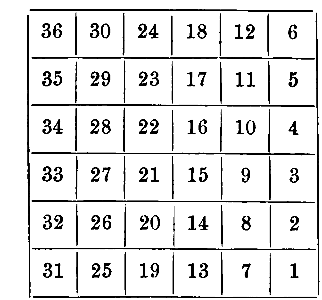
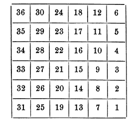
English: the manner in which sections of a township would be numbered according the the en:Land Ordinance of 1785, used only in parts of en:Ohio |
| Date | |
| Source | Higgins, Jerome S. (1887) Subdivisions of the Public Lands, Described and Illustrated, with Diagrams and Maps, Higgins & Co., p. 34 |
| Auteur | Jerome S. Higgins |
Conditions d’utilisation
Ce document est dans le domaine public aux États-Unis. Ceci s'applique aux travaux des États-Unis où le copyright a expiré, souvent parce que sa première publication s'est produite avant le 1er janvier 1929. Voir cette page pour davantage d'explication.
|
 | |
 |
Cette image peut ne pas être dans le domaine public en dehors des États-Unis (ceci s'applique particulièrement au Canada, en Chine (pas Hong Kong, Macao, ni Taïwan), en Allemagne ou en Suisse). Le créateur et l'année de la publication sont l'information essentielle et doivent être fournis.
|
Historique du fichier
Cliquer sur une date et heure pour voir le fichier tel qu'il était à ce moment-là.
| Date et heure | Vignette | Dimensions | Utilisateur | Commentaire | |
|---|---|---|---|---|---|
| actuel | 13 août 2010 à 04:24 | | 1 327 × 1 239 (27 kio) | Roseohioresident | {{Information |Description={{en|1=the manner in which sections of a township would be numbered according the the en:Land Ordinance of 1785, used only in parts of en:Ohio}} |Source={{cite book |title=Subdivisions of the Public Lands, Described an |
Utilisation du fichier
La page suivante utilise ce fichier :
Usage global du fichier
Les autres wikis suivants utilisent ce fichier :
- Utilisation sur ar.wikipedia.org
- Utilisation sur en.wikipedia.org
- Utilisation sur ko.wikipedia.org
- Utilisation sur ru.wikipedia.org