Fichier:Kerala-administrative-divisions-map-en.svg

Taille de cet aperçu PNG pour ce fichier SVG : 540 × 600 pixels. Autres résolutions : 216 × 240 pixels | 432 × 480 pixels | 691 × 768 pixels | 922 × 1 024 pixels | 1 843 × 2 048 pixels | 2 700 × 3 000 pixels.
Fichier d’origine (Fichier SVG, nominalement de 2 700 × 3 000 pixels, taille : 395 kio)
Ce fichier et sa description proviennent de Wikimedia Commons.
Description
| Description |
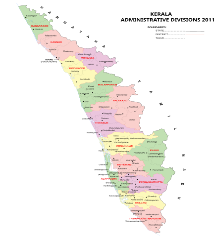
English: Kerala administrative divisions 2011, svg version, English |
| Date | (UTC) |
| Source | Travail personnel |
| Auteur | Rajeshodayanchal |
Conditions d’utilisation
Moi, en tant que détenteur des droits d’auteur sur cette œuvre, je la publie sous la licence suivante :
Ce fichier est disponible selon les termes de la licence Creative Commons Attribution – Partage dans les Mêmes Conditions 3.0 (non transposée).
- Vous êtes libre :
- de partager – de copier, distribuer et transmettre cette œuvre
- d’adapter – de modifier cette œuvre
- Sous les conditions suivantes :
- paternité – Vous devez donner les informations appropriées concernant l'auteur, fournir un lien vers la licence et indiquer si des modifications ont été faites. Vous pouvez faire cela par tout moyen raisonnable, mais en aucune façon suggérant que l’auteur vous soutient ou approuve l’utilisation que vous en faites.
- partage à l’identique – Si vous modifiez, transformez, ou vous basez sur cette œuvre, vous devez distribuer votre contribution sous la même licence ou une licence compatible avec celle de l’original.
Historique du fichier
Cliquer sur une date et heure pour voir le fichier tel qu'il était à ce moment-là.
| Date et heure | Vignette | Dimensions | Utilisateur | Commentaire | |
|---|---|---|---|---|---|
| actuel | 11 mai 2011 à 08:03 | | 2 700 × 3 000 (395 kio) | Rajeshodayanchal | Removed hidden layers from the file |
| 10 mai 2011 à 08:38 |  | 2 700 × 3 000 (458 kio) | Rajeshodayanchal | Some small changes | |
| 9 mai 2011 à 10:56 |  | 2 700 × 3 000 (403 kio) | Rajeshodayanchal | {{Information |Description ={{en|1=Kerala administrative divisions 2011, svg version, English}} |Source ={{own}} |Author =Rajeshodayanchal |Date =~~~~~ |Permission = |other_versions = }} [[Catego |
Utilisation du fichier
La page suivante utilise ce fichier :