Fichier:Karte der ÖPNV-Systeme in den USA.png
Taille de cet aperçu : 800 × 491 pixels. Autres résolutions : 320 × 196 pixels | 640 × 393 pixels | 1 024 × 629 pixels | 1 280 × 786 pixels | 2 204 × 1 353 pixels.
Fichier d’origine (2 204 × 1 353 pixels, taille du fichier : 440 kio, type MIME : image/png)
Ce fichier et sa description proviennent de Wikimedia Commons.
| Description |
|
| Date | see file history |
| Source | Travail personnel |
| Auteur | Maximilian Dörrbecker (Chumwa) |
| Autorisation (Réutilisation de ce fichier) |
Moi, en tant que détenteur des droits d’auteur sur cette œuvre, je la publie sous la licence suivante : Ce fichier est disponible selon les termes de la licence Creative Commons Attribution – Partage dans les Mêmes Conditions 2.5 Générique
Sie dürfen das Bild zu den folgenden Bedingungen nutzen:
|
| Autres versions |
China
Czech Republic France
Germany
Italy
Japan
Korea Poland
Spain & Portugal
Turkey
British Isles Former Soviet Union
Balkans
North Africa
Latin America
United States of America
|


Historique du fichier
Cliquer sur une date et heure pour voir le fichier tel qu'il était à ce moment-là.
| Date et heure | Vignette | Dimensions | Utilisateur | Commentaire | |
|---|---|---|---|---|---|
| actuel | 3 juin 2019 à 21:51 | | 2 204 × 1 353 (440 kio) | Chumwa | update |
| 30 janvier 2018 à 21:04 |  | 2 204 × 1 353 (439 kio) | Chumwa | update | |
| 16 décembre 2017 à 10:32 |  | 2 204 × 1 353 (438 kio) | Chumwa | +Milwaukee | |
| 10 décembre 2014 à 12:22 |  | 2 204 × 1 353 (292 kio) | Kopiersperre | optipng | |
| 30 novembre 2014 à 08:08 |  | 2 204 × 1 353 (443 kio) | Chumwa | correction: Nashville | |
| 28 novembre 2014 à 07:40 |  | 2 204 × 1 353 (444 kio) | Chumwa | +Memphis | |
| 28 novembre 2014 à 00:23 |  | 2 204 × 1 353 (443 kio) | Chumwa | update | |
| 30 mars 2010 à 21:47 |  | 2 172 × 1 353 (407 kio) | Chumwa | commuter rails and some tramway systems added | |
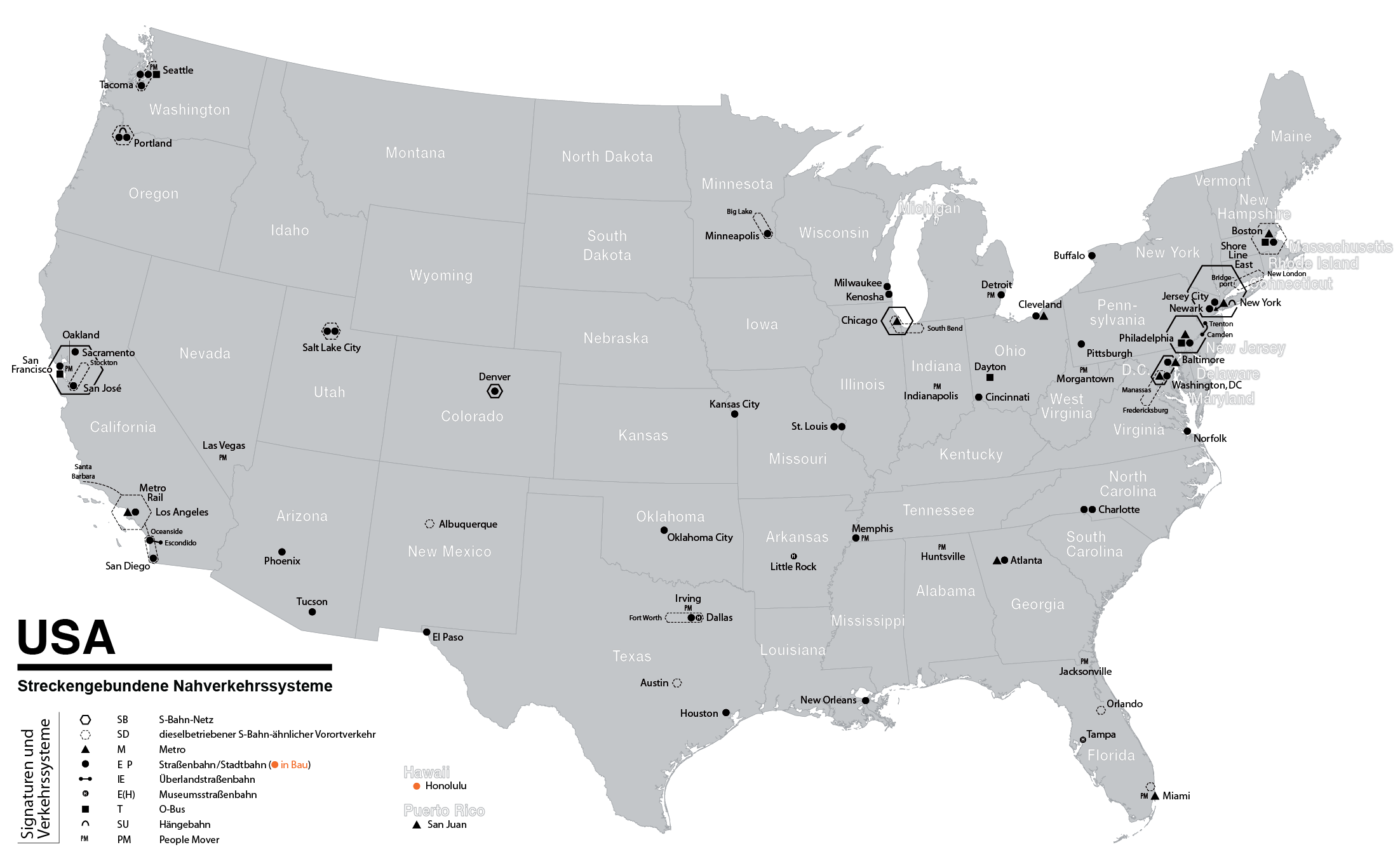
| 6 juin 2009 à 00:37 |  | 2 172 × 1 353 (384 kio) | Chumwa | {{Information |Description= *{{ de }} Karte der streckengebundenen Nahverkehrssysteme (S-Bahn, U-Bahn, Stadtbahn, Straßenbahn, O-Bus) in den USA (Stand: Juni 2009) *{{ en }} Map of fixed-route public transport systems (suburban railways, Rapid Transit an |
Utilisation du fichier
La page suivante utilise ce fichier :
Usage global du fichier
Les autres wikis suivants utilisent ce fichier :
- Utilisation sur cs.wikipedia.org
- Utilisation sur de.wikipedia.org
- Utilisation sur en.wikipedia.org
- Utilisation sur ja.wikipedia.org
- Utilisation sur nl.wikipedia.org
- Utilisation sur sk.wikipedia.org