Fichier:Kalinga sea routes.svg

Taille de cet aperçu PNG pour ce fichier SVG : 749 × 453 pixels. Autres résolutions : 320 × 194 pixels | 640 × 387 pixels | 1 024 × 619 pixels | 1 280 × 774 pixels | 2 560 × 1 548 pixels.
Fichier d’origine (Fichier SVG, nominalement de 749 × 453 pixels, taille : 852 kio)
Ce fichier et sa description proviennent de Wikimedia Commons.

Description
| Description |
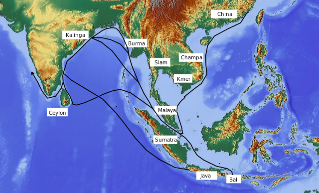
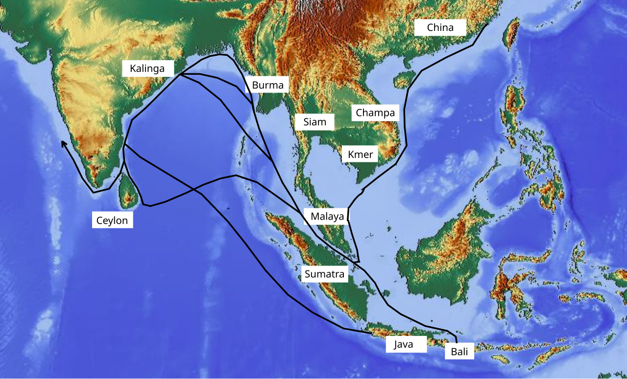
English: Map showing sea routes between Kalinga (ancient Orissa) and trading partners. |
| Date | |
| Source | http://www.maps-for-free.com annotated by author |
| Auteur | Aymatth2 |
Conditions d’utilisation
Ce fichier est disponible selon les termes de la licence Creative Commons Attribution – Partage dans les Mêmes Conditions 3.0 (non transposée).
- Vous êtes libre :
- de partager – de copier, distribuer et transmettre cette œuvre
- d’adapter – de modifier cette œuvre
- Sous les conditions suivantes :
- paternité – Vous devez donner les informations appropriées concernant l'auteur, fournir un lien vers la licence et indiquer si des modifications ont été faites. Vous pouvez faire cela par tout moyen raisonnable, mais en aucune façon suggérant que l’auteur vous soutient ou approuve l’utilisation que vous en faites.
- partage à l’identique – Si vous modifiez, transformez, ou vous basez sur cette œuvre, vous devez distribuer votre contribution sous la même licence ou une licence compatible avec celle de l’original.
Historique du fichier
Cliquer sur une date et heure pour voir le fichier tel qu'il était à ce moment-là.
| Date et heure | Vignette | Dimensions | Utilisateur | Commentaire | |
|---|---|---|---|---|---|
| actuel | 20 novembre 2010 à 16:06 | | 749 × 453 (852 kio) | Aymatth2 | {{Information |Description={{en|1=Map showing sea routes between Kalinga (ancient Orissa) and trading partners.}} |Source=http://www.maps-for-free.com annotated by author |Author=Aymatth2 |Date=2010-11-20 |Permission= |other_versions= }} [[Category:Oriss |
Utilisation du fichier
La page suivante utilise ce fichier :
Usage global du fichier
Les autres wikis suivants utilisent ce fichier :
- Utilisation sur or.wikipedia.org