Fichier:Isla Hoste.png
Pas de plus haute résolution disponible.
Isla_Hoste.png (391 × 500 pixels, taille du fichier : 410 kio, type MIME : image/png)
Ce fichier et sa description proviennent de Wikimedia Commons.
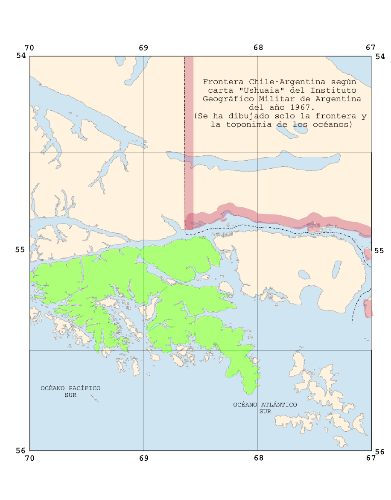
| Description | w:Hoste Island on a map of the southern part of the Archipelago of Tierra del Fuego, Borderline Chile-Argentina according to a map edited 1967 by the Argentine "Instituto Geografico Militar". The map is included in the book "El Conflicto del Beagle", edited by the Chilean Foreign Affairs Office, 1978, Switzerland. | ||||||||||
| Date | (UTC) | ||||||||||
| Source |
based on Image:Ushuaia.igm.arg.1967.png, changes made by myself self-made |
||||||||||
| Auteur | this image: Man77, source made by User:Createaccount | ||||||||||
| Autorisation (Réutilisation de ce fichier) |
|

Historique du fichier
Cliquer sur une date et heure pour voir le fichier tel qu'il était à ce moment-là.
| Date et heure | Vignette | Dimensions | Utilisateur | Commentaire | |
|---|---|---|---|---|---|
| actuel | 28 mars 2008 à 16:20 | | 391 × 500 (410 kio) | Man77 | {{Information |Description=w:Hoste Island on a map of the southern part of the Archipelago of Tierra del Fuego, Borderline Chile-Argentina according to a map edited 1967 by the Argentine "Instituto Geografico Militar". The map is included in the book |
Utilisation du fichier
La page suivante utilise ce fichier :
Usage global du fichier
Les autres wikis suivants utilisent ce fichier :
- Utilisation sur ca.wikipedia.org
- Utilisation sur it.wikipedia.org
- Utilisation sur sh.wikipedia.org
- Utilisation sur www.wikidata.org
- Utilisation sur zh.wikipedia.org