Fichier:Indonesia Maluku location map.svg

Taille de cet aperçu PNG pour ce fichier SVG : 600 × 600 pixels. Autres résolutions : 240 × 240 pixels | 480 × 480 pixels | 768 × 768 pixels | 1 024 × 1 024 pixels | 2 048 × 2 048 pixels | 1 250 × 1 250 pixels.
Fichier d’origine (Fichier SVG, nominalement de 1 250 × 1 250 pixels, taille : 6,75 Mio)
Ce fichier et sa description proviennent de Wikimedia Commons.
Description
| Description |
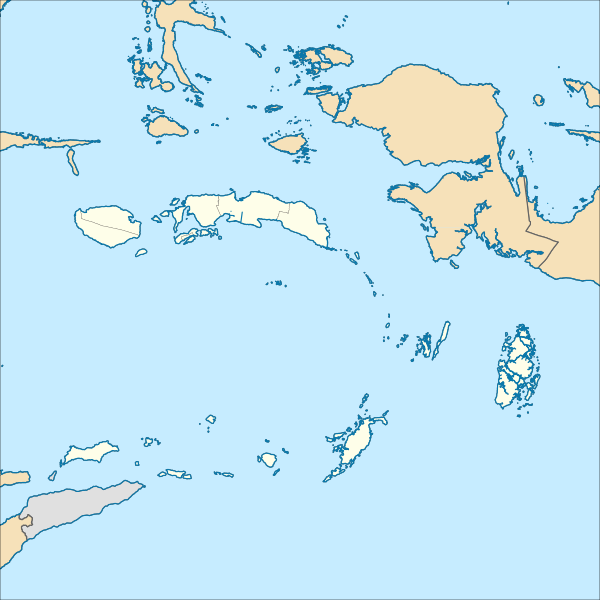
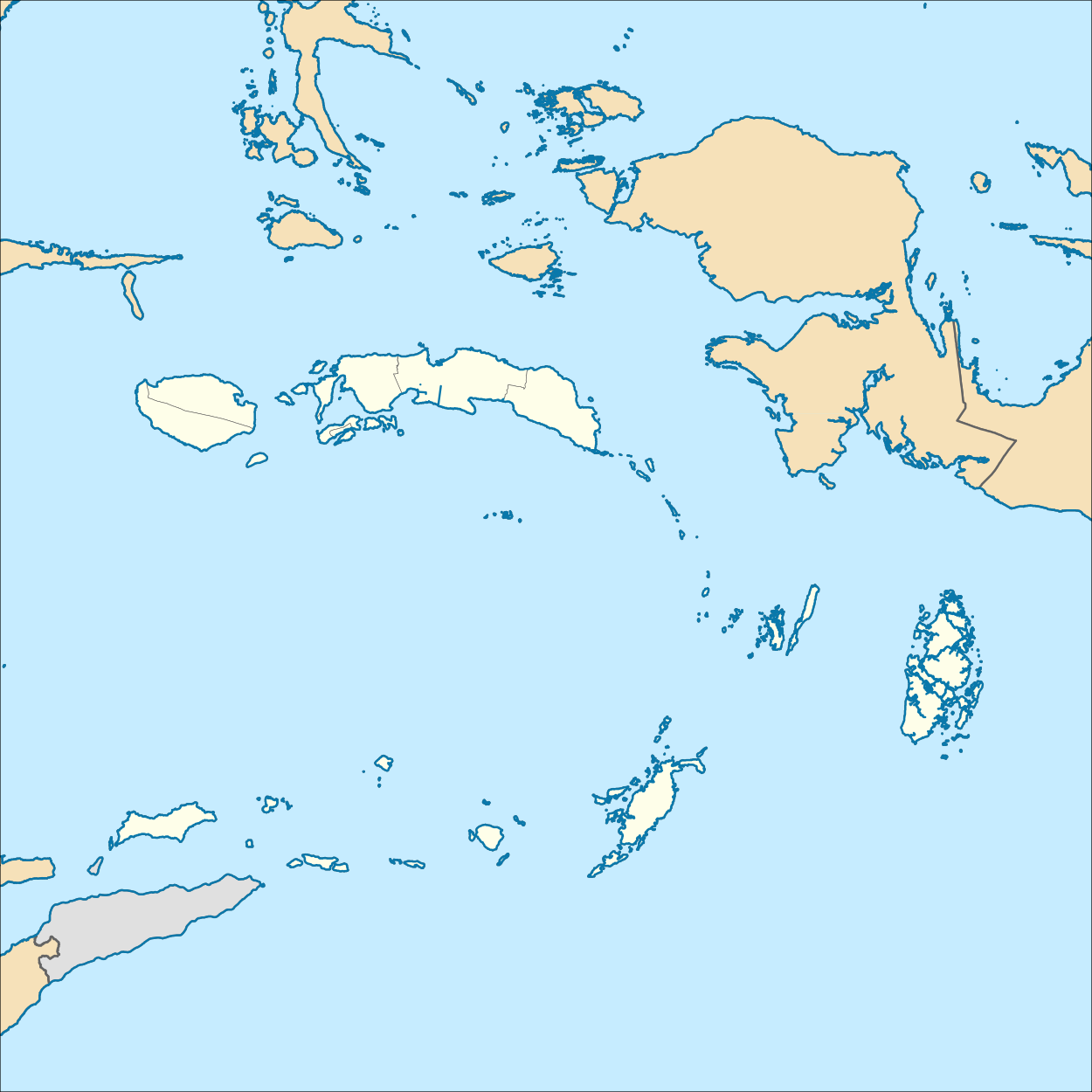
English: Location map of Maluku, Indonesia
Geographic Coordinate System WGS 1984 (EPSG: 4326) Equirectangular Projection Geographic limits of the map:
|
| Date | |
| Source | Travail personnel |
| Auteur | Mandamaruta |
Conditions d’utilisation
Moi, en tant que détenteur des droits d’auteur sur cette œuvre, je la publie sous la licence suivante :
Ce fichier est sous la licence Creative Commons Attribution – Partage dans les Mêmes Conditions 4.0 International.
- Vous êtes libre :
- de partager – de copier, distribuer et transmettre cette œuvre
- d’adapter – de modifier cette œuvre
- Sous les conditions suivantes :
- paternité – Vous devez donner les informations appropriées concernant l'auteur, fournir un lien vers la licence et indiquer si des modifications ont été faites. Vous pouvez faire cela par tout moyen raisonnable, mais en aucune façon suggérant que l’auteur vous soutient ou approuve l’utilisation que vous en faites.
- partage à l’identique – Si vous modifiez, transformez, ou vous basez sur cette œuvre, vous devez distribuer votre contribution sous la même licence ou une licence compatible avec celle de l’original.
Historique du fichier
Cliquer sur une date et heure pour voir le fichier tel qu'il était à ce moment-là.
| Date et heure | Vignette | Dimensions | Utilisateur | Commentaire | |
|---|---|---|---|---|---|
| actuel | 21 décembre 2017 à 09:59 | | 1 250 × 1 250 (6,75 Mio) | Mandamaruta | User created page with UploadWizard |
Utilisation du fichier
La page suivante utilise ce fichier :
Usage global du fichier
Les autres wikis suivants utilisent ce fichier :
- Utilisation sur en.wikipedia.org
- Ambon Island
- Seram Island
- Ambon, Maluku
- Aru Islands Regency
- Waigeo
- Yamdena
- Sula Islands Regency
- List of national parks of Indonesia
- Obi (island)
- Taliabu Island Regency
- Mangole Island
- Sanana
- Emperor of China (volcano)
- Nieuwerkerk (volcano)
- Manuk
- Pattimura International Airport
- Maba, Indonesia
- Trangan
- Misool
- Kobroor
- Tanahbesar
- Kai Besar
- Kai Kecil
- Batanta
- Maikoor
- Module:Location map/data/Indonesia Maluku/doc
- Sultan Babullah Airport
- Manusela National Park
- Aketajawe-Lolobata National Park
- West Halmahera Regency
- South Halmahera Regency
- Central Halmahera Regency
- East Halmahera Regency
- Buru Regency
- Central Maluku Regency
- South Buru Regency
- Southeast Maluku Regency
- Southwest Maluku Regency
- Tanimbar Islands Regency
- West Seram Regency
- East Seram Regency
- Rar Gwamar Airport
- Namrole Airport
- Namniwel Airport
- Tual
- Nusa Laut
- Uruangnirin language
- As language
- Bandanaira Airport
- 1899 Ceram earthquake
Voir davantage sur l’utilisation globale de ce fichier.