Fichier:ISS-61 James Bay, Canada.jpg

Taille de cet aperçu : 800 × 533 pixels. Autres résolutions : 320 × 213 pixels | 640 × 427 pixels | 1 024 × 683 pixels | 1 280 × 853 pixels | 2 560 × 1 707 pixels | 5 568 × 3 712 pixels.
Fichier d’origine (5 568 × 3 712 pixels, taille du fichier : 3,84 Mio, type MIME : image/jpeg)
Ce fichier et sa description proviennent de Wikimedia Commons.
Description
| Description |
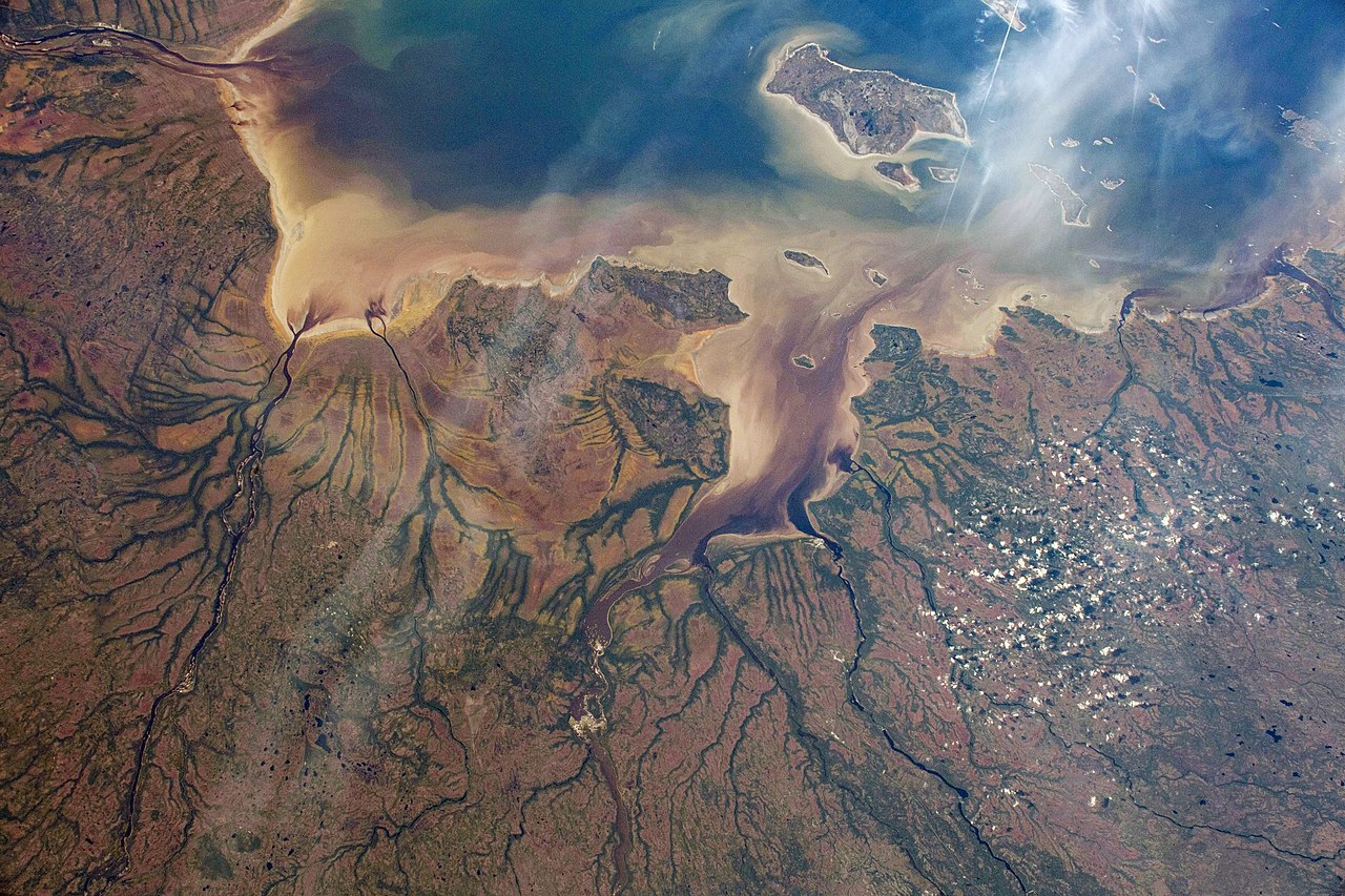
English: The Nottaway River empties into the southern tip of James Bay in the Canadian province of Quebec. The International Space Station was orbiting 252 miles above North America and 189 miles south of James Bay at the time this photograph was taken. |
| Date | Prise le 8 octobre 2019 |
| Source | https://www.flickr.com/photos/nasa2explore/48959542722/ |
| Auteur | NASA |
| Autres versions |
.jpg)
Cette image ou vidéo a été cataloguée par le Johnson Space Center de la National Aeronautics and Space Administration (NASA) des États-Unis sous Photo ID : ISS061-E-004579.Ce bandeau n’indique rien sur le statut de l’œuvre au regard du droit d'auteur. Un bandeau de droit d’auteur est requis. Voir Commons:À propos des licences pour plus d’informations. Autres langues :
|
Conditions d’utilisation
| This image, originally posted to Flickr, is currently not available on Flickr under the license specified on this page. However, please see {{PD-USGov-NASA-AP}} for permission to use it under this license. |
"The Gateway to Astronaut Photography of Earth". Image provenant du Laboratoire d'Analyse et d'Imagerie des Sciences, Centre Spatial Johnson de la NASA.
Source de la photo : ISS061-E-004579.
|
Historique du fichier
Cliquer sur une date et heure pour voir le fichier tel qu'il était à ce moment-là.
| Date et heure | Vignette | Dimensions | Utilisateur | Commentaire | |
|---|---|---|---|---|---|
| actuel | 31 octobre 2019 à 04:58 | | 5 568 × 3 712 (3,84 Mio) | Ras67 | 180 degree rotated, levels/colors adjusted |
| 31 octobre 2019 à 04:55 |  | 5 568 × 3 712 (2,68 Mio) | Ras67 | == {{int:filedesc}} == {{Information |description={{en|1=The Nottaway River empties into the southern tip of James Bay in the Canadian province of Quebec. The International Space Station was orbiting 252 miles above North America and 189 miles south of James Bay at the time this photograph was taken.}} |date={{taken on|2019-10-08}} |source=https://www.flickr.com/photos/nasa2explore/48959542722/ |author=NASA |permission= |other versions= }} {{NASA-image|center=JSC|id=ISS061-E-004579}} == {{in... |
Utilisation du fichier
La page suivante utilise ce fichier :
Usage global du fichier
Les autres wikis suivants utilisent ce fichier :