Fichier:Flores Locator Topography.png

Taille de cet aperçu : 800 × 473 pixels. Autres résolutions : 320 × 189 pixels | 640 × 379 pixels | 1 024 × 606 pixels | 1 280 × 757 pixels | 2 559 × 1 514 pixels.
Fichier d’origine (2 559 × 1 514 pixels, taille du fichier : 1,46 Mio, type MIME : image/png)
Ce fichier et sa description proviennent de Wikimedia Commons.
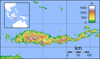
| Description | Topographic map of Flores, Indonesia. Created with GMT from SRTM data. |
| Date | (UTC) |
| Source | |
| Auteur |
|
| Cette image a été retouchée, ce qui signifie qu'elle a été modifiée par ordinateur et est différente de l'image d'origine. Liste des modifications : croped margins. L'image d'origine se trouve ici : Flores Topography.png:
|
Moi, en tant que détenteur des droits d’auteur sur cette œuvre, je la publie sous les licences suivantes :
Ce fichier est sous licence Creative Commons Attribution – Partage dans les Mêmes Conditions 3.0 (non transposée), 2.5 Générique, 2.0 Générique et 1.0 Générique.
- Vous êtes libre :
- de partager – de copier, distribuer et transmettre cette œuvre
- d’adapter – de modifier cette œuvre
- Sous les conditions suivantes :
- paternité – Vous devez donner les informations appropriées concernant l'auteur, fournir un lien vers la licence et indiquer si des modifications ont été faites. Vous pouvez faire cela par tout moyen raisonnable, mais en aucune façon suggérant que l’auteur vous soutient ou approuve l’utilisation que vous en faites.
- partage à l’identique – Si vous modifiez, transformez, ou vous basez sur cette œuvre, vous devez distribuer votre contribution sous la même licence ou une licence compatible avec celle de l’original.

|
Vous avez la permission de copier, distribuer et modifier ce document selon les termes de la GNU Free Documentation License version 1.2 ou toute version ultérieure publiée par la Free Software Foundation, sans sections inaltérables, sans texte de première page de couverture et sans texte de dernière page de couverture. Un exemplaire de la licence est inclus dans la section intitulée GNU Free Documentation License. |
Vous pouvez choisir l’une de ces licences.
Journal des téléversements d’origine
This image is a derivative work of the following images:
- File:Flores_Topography.png licensed with Cc-by-sa-3.0,2.5,2.0,1.0, GFDL
- 2007-09-11T21:28:50Z Sadalmelik 2745x1665 (1468315 Bytes) {{Information |Description=Topographic map of Flores, Indonesia. Created with GMT from SRTM data. |Source=self-made |Date=Sep 11, 2007 |Author= [[User:Sadalmelik|Sadalmelik]] }} [[Category:Maps of Indonesia]] [[Category:Topo
Téléversé avec derivativeFX
Historique du fichier
Cliquer sur une date et heure pour voir le fichier tel qu'il était à ce moment-là.
| Date et heure | Vignette | Dimensions | Utilisateur | Commentaire | |
|---|---|---|---|---|---|
| actuel | 1 février 2010 à 06:20 | | 2 559 × 1 514 (1,46 Mio) | Elekhh | {{Information |Description=Topographic map of Flores, Indonesia. Created with GMT from SRTM data. |Source=*File:Flores_Topography.png |Date=2010-02-01 04:17 (UTC) |Author=*File:Flores_Topography.png: Sadalmelik *derivative |
Utilisation du fichier
Les 2 pages suivantes utilisent ce fichier :
Usage global du fichier
Les autres wikis suivants utilisent ce fichier :
- Utilisation sur ar.wikipedia.org
- Utilisation sur arz.wikipedia.org
- Utilisation sur ban.wikipedia.org
- Utilisation sur ceb.wikipedia.org
- Utilisation sur en.wikipedia.org
- Komodo National Park
- Iliboleng
- Paluweh
- Kelimutu
- Palu'e language
- List of national parks of Indonesia
- Sikka Regency
- Ende Regency
- Ende (town)
- Maumere
- Poco Mandasawu
- Ranakah
- Lewotobi
- Leroboleng
- Mount Egon
- Ebulobo
- Inierie
- Mount Iya
- Inielika
- Wai Sano
- Sumba Strait
- Kelimutu National Park
- Larantuka
- H. Hasan Aroeboesman Airport
- Komodo International Airport
- Frans Xavier Seda Airport
- 1992 Flores earthquake and tsunami
- Ruteng
- Ngada Regency
- West Manggarai Regency
- East Flores Regency
- Manggarai Regency
- Nagekeo Regency
- East Manggarai Regency
- Labuan Bajo
- Module:Location map/data/Indonesia Flores/doc
Voir davantage sur l’utilisation globale de ce fichier.