Fichier:Argyre MOLA zoom 64.jpg
Taille de cet aperçu : 712 × 600 pixels. Autres résolutions : 285 × 240 pixels | 570 × 480 pixels | 911 × 768 pixels | 1 215 × 1 024 pixels | 2 431 × 2 048 pixels | 4 220 × 3 556 pixels.
Fichier d’origine (4 220 × 3 556 pixels, taille du fichier : 6,74 Mio, type MIME : image/jpeg)
Ce fichier et sa description proviennent de Wikimedia Commons.
Description
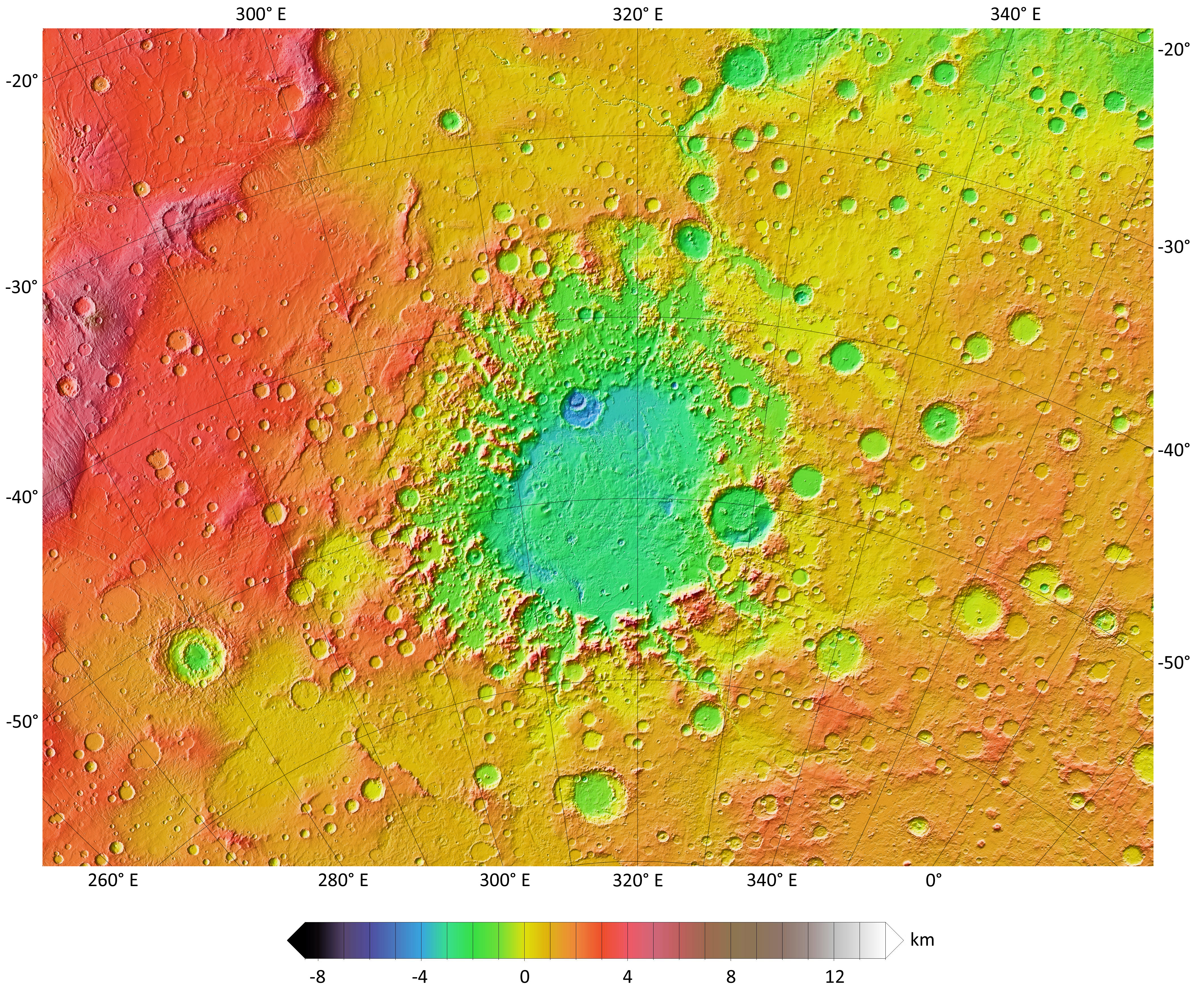
| Description |
English: A colorized topographic map of the martian impact basin Argyre, together with its surroundings, from the Mars Orbiter Laser Altimeter (MOLA) instrument of the Mars Global Surveyor spacecraft. Argyre, the second deepest basin on Mars, lies in the southern hemisphere, southeast of the canyon system Valles Marineris. Some of the features in this image have been annotated in Wikimedia Commons. |
| Date | |
| Source | JMARS |
| Auteur | NASA / JPL-Caltech / Arizona State University |
| Autres versions |
.jpg)
Conditions d’utilisation
| Ce fichier provient de la NASA. Sauf exception, les documents créés par la NASA ne sont pas soumis à copyright. Pour plus d'informations, voir la politique de copyright de la NASA. | ||
 |
Attention :
|
| Annotations | Cette image est annotée : Voir les annotations sur Wikimedia Commons |
Historique du fichier
Cliquer sur une date et heure pour voir le fichier tel qu'il était à ce moment-là.
| Date et heure | Vignette | Dimensions | Utilisateur | Commentaire | |
|---|---|---|---|---|---|
| actuel | 30 novembre 2013 à 00:23 | | 4 220 × 3 556 (6,74 Mio) | WolfmanSF | increase font size in elevation key |
| 28 novembre 2013 à 08:44 |  | 4 220 × 3 556 (6,74 Mio) | WolfmanSF | User created page with UploadWizard |
Utilisation du fichier
La page suivante utilise ce fichier :
Usage global du fichier
Les autres wikis suivants utilisent ce fichier :
- Utilisation sur de.wikipedia.org
- Utilisation sur el.wikipedia.org
- Utilisation sur en.wikipedia.org
- Utilisation sur it.wikipedia.org
- Utilisation sur lb.wikipedia.org
- Utilisation sur pt.wikipedia.org
- Utilisation sur ru.wikipedia.org
- Utilisation sur uk.wikipedia.org